Current Auction
"[Lot of 2] Carte de l'Isle de Caienne, et de ses Environs [and] Carte de l'Isle de Cayenne", Bellin, Jacques Nicolas
Subject: Cayenne, French Guiana
Period: 1753-64 (circa)
Publication:
Color: Hand Color
Size:
See Description
Download High Resolution Image
(or just click on image to launch the Zoom viewer)
(or just click on image to launch the Zoom viewer)
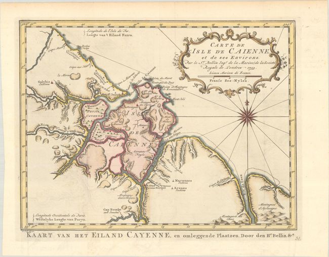
A. Carte de l'Isle de Caienne, et de ses Environs, by Bellin/Van Schley, from Raynal's Histoire Philosophique et Politique…, dated 1753 (11.2 x 8.5"). Attractive chart of the coast of French Guyana locating the important fortifications and natural harbor of Cayenne. It is decorated with a fine title cartouches and a compass rose. Dutch title at bottom: Kaart van het Eiland Cayenne, en Omleggende Plaatzen. Condition: A crisp impression issued folding on a sheet with a fleur-de-lis watermark. There is minor offsetting.
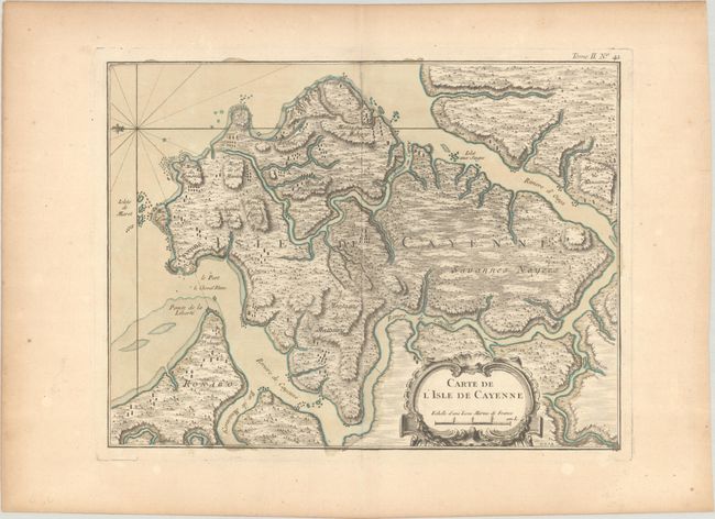
B. Carte de l'Isle de Cayenne, from Le Petit Atlas Maritime..., published 1764 (12.7 x 9.6"). This handsome map of the Isle de Cayenne features remarkable topographical detail. The fortified city, mountains, and several settlements are located. A decorative title cartouche appears at bottom right. North is oriented to the left. Condition: A nice impression on watermarked paper with minor toning.
References:
Condition: A
See description above.
Estimate: $120 - $150
Current High Bid:
$0
Reserve: Reserve Not Met
Next Bid: $60
Bid Increments
$50 - $99$5
$100 - $249$10
$250 - $499$25
$500 - $999$50
Terms & Conditions