Current Auction
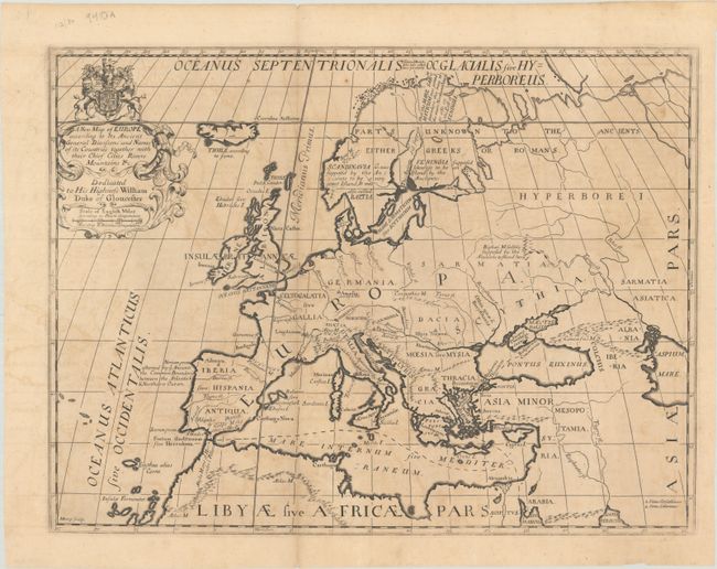
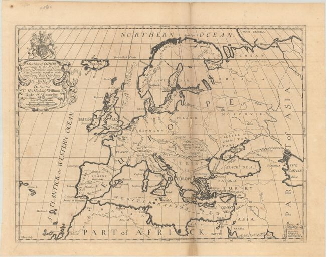
"[Lot of 2] A New Map of Europe According to Its Ancient General Divisions and Names of Its Countries... [and] A New Map of Europe According to the Present General Divisions and Names...", Wells, Edward
Subject: Europe
Period: 1701 (circa)
Publication: A New Sett of Maps both of Antient and Present Geography
Color: Black & White
Size:
19.4 x 14.6 inches
49.3 x 37.1 cm
Download High Resolution Image
(or just click on image to launch the Zoom viewer)
(or just click on image to launch the Zoom viewer)
A nice pair of copper engraved maps which present the European continent with both ancient and "modern" names. The physical geography is identical on both maps with modest detail of rivers, mountains, coastlines and islands. Both Italy and Ireland are strangely shaped. The large title cartouches at top left are surmounted with the coat of arms of Prince William, Duke of Gloucester, who was Wells' student at Oxford and to whom the map is dedicated. Both maps were engraved by Michael Burghers.
References: Shirley (BL Atlases) T.WELL-1a #3 & #4.
Condition: B
On watermarked paper with some light toning and offsetting. The modern map has an archivally repaired 1.75" fold separation at bottom. The ancient map has a printer's crease at right and a few small chips (loss) along the fold, which has been backed with paper on verso.
Estimate: $275 - $350
Current High Bid:
$0
Reserve: Reserve Not Met
Next Bid: $140
Bid Increments
$100 - $249$10
$250 - $499$25
$500 - $999$50
$1,000 - $2,499$100
Terms & Conditions