Current Auction
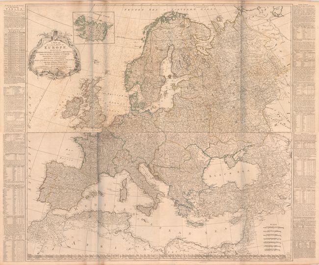
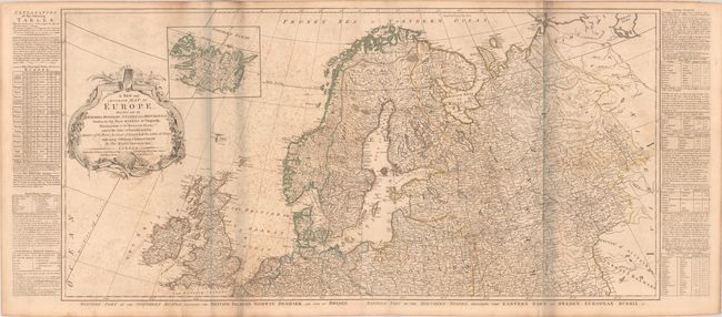
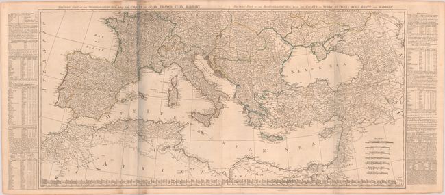
"[On 2 Joined Sheets] A New and Accurate Map of Europe. Divided Into Its Empires, Kingdoms, States and Republics, &c. Drawn by the Sieur Robert de Vaugondy...", Kitchin, Thomas
Subject: Europe
Period: 1772 (dated)
Publication: General Atlas
Color: Hand Color
Size:
41.3 x 20.2 inches
104.9 x 51.3 cm
Download High Resolution Image
(or just click on image to launch the Zoom viewer)
(or just click on image to launch the Zoom viewer)
This is Kitchin's version of Robert de Vaugondy's detailed four-sheet map of Europe. Germany, Poland, Hungary and Turkey encompass nearly all of central and eastern Europe. Named places are shown in abundance and boundaries are included. An inset of Iceland appears above the decorative title cartouche. Tables at sides provide a wealth of information on the major empires, and the flags of all the nations are aligned along the bottom of the southern sheet. This edition was published by Robert Sayer. Printed on four separate sheets and joined into two horizontal pairs.
References: Phillips (Atlases) #653-3 & 4.
Condition: B
Contemporary outline color on watermarked sheets. The northern half has moderate foxing. The southern half has some light offsetting, creasing along one fold, and a couple of short edge tears at bottom. The first image is a composite image - the map is joined in two horizontal sections.
Estimate: $700 - $850
Current High Bid:
$0
Reserve: Reserve Not Met
Next Bid: $350
Bid Increments
$250 - $499$25
$500 - $999$50
$1,000 - $2,499$100
$2,500 - $4,999$250
Terms & Conditions