Current Auction
"Carte des Isles Britanniques, Contenant les Royaumes d'Angleterre, d'Ecosse et d'Irlande", Bonne, Rigobert
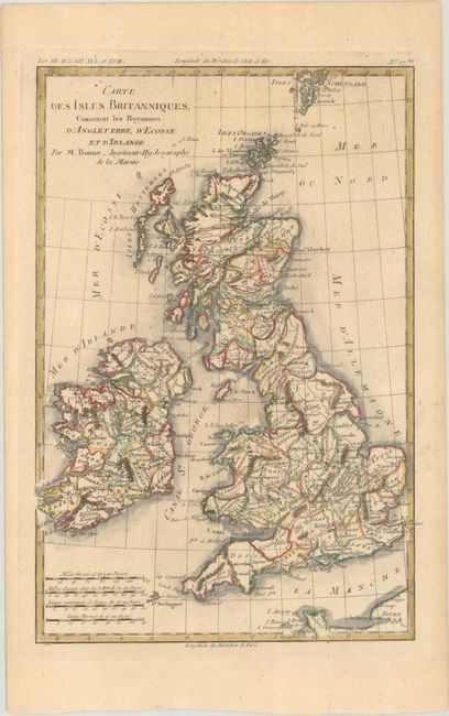
Subject: Britain
Period: 1780 (circa)
Publication: Atlas de Toutes les Parties Connues du Globe Terrestre
Color: Hand Color
Size:
8.6 x 12.6 inches
21.8 x 32 cm
Download High Resolution Image
(or just click on image to launch the Zoom viewer)
(or just click on image to launch the Zoom viewer)
This detailed copper engraved map shows all of Britain, including the Shetland Isles, and extends to the Normandy coast. There is nice detail of counties and major cities.
References:
Condition: B+
A crisp impression on a lightly toned sheet.
Estimate: $90 - $110
Current High Bid:
$0
Reserve: Reserve Not Met
Next Bid: $45
Bid Increments
Under $50$1
$50 - $99$5
$100 - $249$10
$250 - $499$25
$500 - $999$50
Terms & Conditions