Current Auction
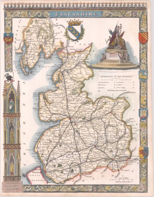
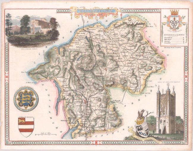
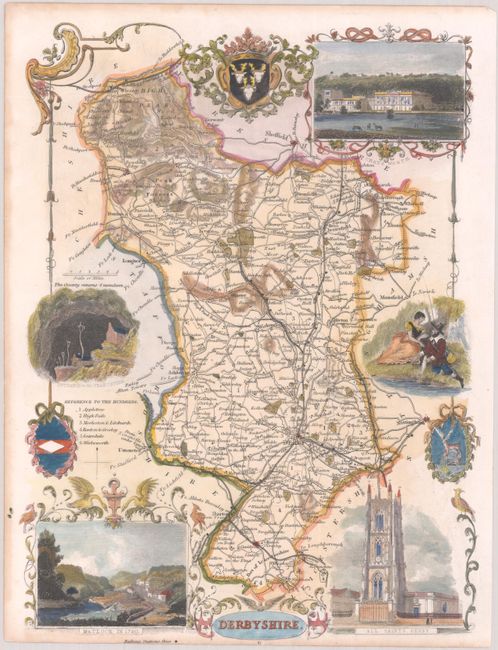
"[Lot of 3] Lancashire [and] Westmoreland [and] Derbyshire", Moule, Thomas
Subject: Northern England
Period: 1850 (circa)
Publication:
Color: Hand Color
Size:
See Description
Download High Resolution Image
(or just click on image to launch the Zoom viewer)
(or just click on image to launch the Zoom viewer)
Thomas Moule (1784 – 1851) was a writer, bookseller, publisher, topographer and a scholar in heraldry. His varied career led him in 1830 to produce a series of English county map based on his own travel. He wrote that he has “with expensive diligence personally visited every county in England, excepting only Devonshire and Cornwall.” His maps were delicately engraved on steel in a highly decorative style, featured such embellishments as armorial bearings, figures, fancy borders and vignettes of local interest. This amount of ornamentation in mapmaking was unusual for the period as most mapmaker’s were instead creating scientifically accurate, austere works. His series of county maps were originally published in separate sections for each county (1830-32), then subsequently published in a two-volume work: The English Counties Delineated…, (1836). Beginning in 1841, the maps appeared in Barclays Complete and Universal English Dictionary.
An attractive lot of steel engraved maps providing detailed county information including cities, towns, roads, railroads, canals and parks. Lancashire (8.0 x 10.4") features a vignette of Nelson's Monument, Liverpool. Westmoreland (10.5 x 7.9") includes vignettes of Brougham Hall and Keep of Appleby Castle. Illustrations on Derbyshire (7.8 x 10.6") feature Derby Cathedral, Chatsworth, Matlock in 1790, and the entrance to the Peak Cavern. Each is ornately decorated with coats of arms and elegant borders featuring both floral and architectural elements.
References:
Condition: A
Colorful examples on clean sheets with minor dampstaining along the sheet edges.
Estimate: $110 - $140
Current High Bid:
$0
Reserve: Reserve Not Met
Next Bid: $55
Bid Increments
$50 - $99$5
$100 - $249$10
$250 - $499$25
$500 - $999$50
Terms & Conditions