Current Auction
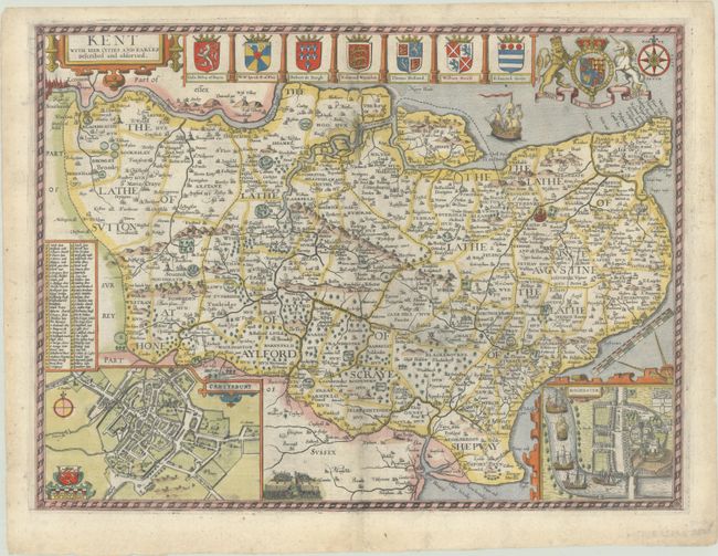
"Kent with Her Cities and Earles Described and Observed", Speed, John
Subject: Southeastern England
Period: 1614 (circa)
Publication: The Theatre of the Empire of Great Britaine
Color: Hand Color
Size:
19.9 x 14.9 inches
50.5 x 37.8 cm
Download High Resolution Image
(or just click on image to launch the Zoom viewer)
(or just click on image to launch the Zoom viewer)
This highly decorative map of Kent provides fascinating detail of the county, with London shown at the top left corner of the engraving. Inset plans of Canterbury and Rochester are included at bottom. A lovely border surrounds the map along with the royal crest, the arms of nine Earls, a compass rose, a sailing ship, and a battle scene. English text on verso.
References: Shirley (BL Atlases) T.SPE-1b.
Condition: B+
A nice impression on a sturdy sheet with a coat of arms watermark, light printer's ink residue, and an archivally repaired centerfold separation at bottom.
Estimate: $900 - $1,100
Current High Bid:
$450
Reserve: Reserve Not Met
Next Bid: $475
Bid Increments
$250 - $499$25
$500 - $999$50
$1,000 - $2,499$100
$2,500 - $4,999$250
Terms & Conditions