Current Auction
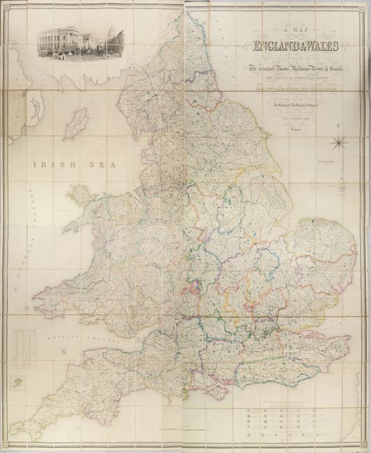
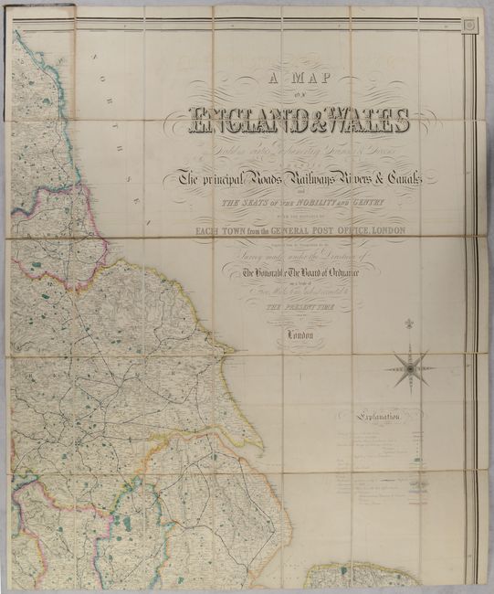
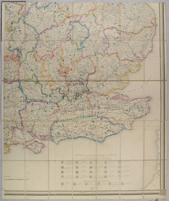
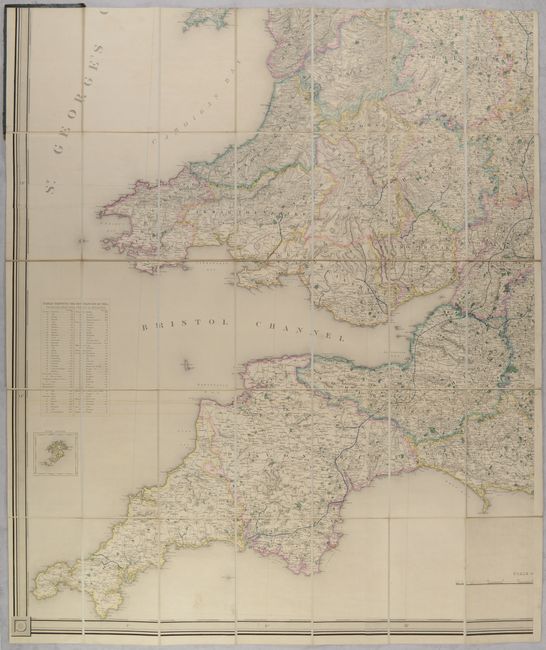
"[On 4 Sheets] A Map of England & Wales Divided Into Counties Parliamentary Divisions & Dioceses Shewing the Principal Roads Railways Rivers & Canals...", Lewis, Samuel

Subject: England & Wales
Period: 1850 (circa)
Publication:
Color: Hand Color
Size:
33.8 x 41.1 inches
85.9 x 104.4 cm
Download High Resolution Image
(or just click on image to launch the Zoom viewer)
(or just click on image to launch the Zoom viewer)
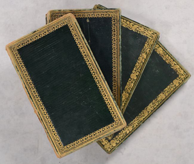
A large and handsome map drawn by R. Creighton and engraved by John Dower. It covers all of England and Wales, the Isle of Man, and portions of Scotland and Northern Ireland in outline on a remarkable scale of 5 miles per inch. A legend at bottom right identifies the symbols used to identify cities, hamlets, parishes, churches, parks, postal roads, canals and more. The map is also filled with physical features including rivers, lakes and topography through fine hachuring. There is a table of distances by sea between various English ports at left and a table presenting the various dioceses of the Church of England at bottom right. The map also features a lovely illustration of the London Post Office at top left and a tiny inset of the Isles of Scilly at lower left. Surrounded by a keyboard-style border. Composed of four sheets, dissected and backed with linen, which fold into green leather boards. If joined together, the map would measure a staggering 68 x 82".
References:
Condition: B+
Contemporary color with some minor soiling and faint offsetting. Dissected and backed with contemporary linen. Covers have some light wear and scuffs. Spines have all perished, resulting in one loose board per section. The first image is a composite image - the map is on four separate sheets.
Estimate: $600 - $750
Current High Bid:
$400
Reserve: Reserve Met
Next Bid: $425
Bid Increments
$250 - $499$25
$500 - $999$50
$1,000 - $2,499$100
$2,500 - $4,999$250
Terms & Conditions