Current Auction
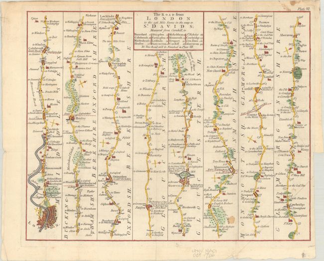
"The Road from London to the 196 Mile Stone in the Way to St. Davids; Measured from Cornhill...", Anon.
Subject: Southern England & Wales
Period: 1766 (published)
Publication: Universal Magazine
Color: Hand Color
Size:
14.4 x 11.7 inches
36.6 x 29.7 cm
Download High Resolution Image
(or just click on image to launch the Zoom viewer)
(or just click on image to launch the Zoom viewer)
Based on original surveys by John Ogilby, this strip-style road map delineates the route from London to the vicinity of present-day Port Talbot in Wales. Along the way the map depicts towns, churches, bridges, forests, castle ruins, and more. Notables towns and cities named along the route include Cardiff, Monmouth, Gloucester, and Abingdon. London appears in plan form with the River Thames prominently shown. Plate IV in a 39-part series of British road maps published in Universal Magazine from October 1765 to December 1773.
References: Jolly #UNIV-132.
Condition: B+
Issued folding on a sheet with a Pro Patria watermark. There is small stain in the Monmouthshire panel, an extraneous crease at bottom right, and a binding trim in the right margin with an associated tear that extends 4" into map image and has been closed on verso with archival tape.
Estimate: $110 - $140
Current High Bid:
$80
Reserve: Reserve Met
Next Bid: $85
Bid Increments
$50 - $99$5
$100 - $249$10
$250 - $499$25
$500 - $999$50
Terms & Conditions