Auction closes in 5d 22h
Current Auction
"A New Map of Ireland from the Latest Observatio", Senex, John
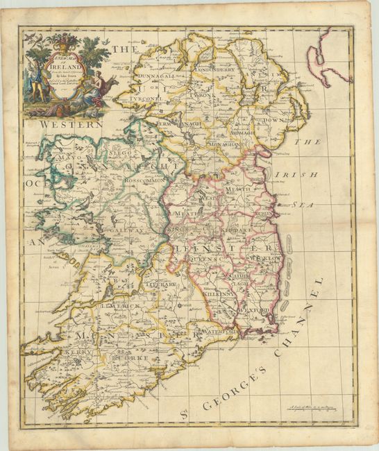
Subject: Ireland
Period: 1720 (dated)
Publication: A New General Atlas
Color: Hand Color
Size:
19.3 x 22.9 inches
49 x 58.2 cm
Download High Resolution Image
(or just click on image to launch the Zoom viewer)
(or just click on image to launch the Zoom viewer)
A fine, large map of Ireland with wonderful topographical detail, political boundaries, and place names throughout. Several interesting features are included, such as the ancient pilgrimage site at Saint Patrick’s Purgatory and a salmon fishery in County Mayo. The delicately engraved title cartouche features a harpist, a bull, and sheep.
References: Shirley (BL Atlases) T.SEN-2a #24.
Condition: B+
A nice impression with contemporary outline color in the map and later color in the cartouche, on a sheet with the watermarks of "AB" and a fleur-de-lis. There is light toning along the centerfold, light soiling, and a centerfold separation that just enters the map border at left. Remnants of hinge tape on verso.
Estimate: $475 - $600
Current High Bid:
$0
Reserve: Reserve Not Met
Next Bid: $240
Bid Increments
$100 - $249$10
$250 - $499$25
$500 - $999$50
$1,000 - $2,499$100
Terms & Conditions