Current Auction
"Ultoniae Orientalis Pars", Mercator/Hondius
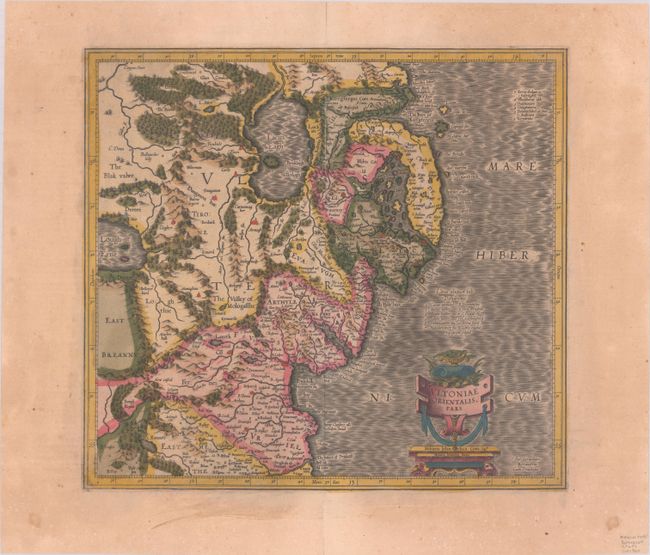
Subject: Northern Ireland
Period: 1613 (circa)
Publication: Gerardi Mercatoris - Atlas sive Cosmographicae…
Color: Hand Color
Size:
15 x 13.8 inches
38.1 x 35.1 cm
Download High Resolution Image
(or just click on image to launch the Zoom viewer)
(or just click on image to launch the Zoom viewer)
Superb early map covering Down and Antrim Counties in Northern Ireland. This was one of five Irish maps Gerard Mercator designed for the second part of his Atlas. It is beautifully engraved with a moiré pattern in the sea, strong topographical features in the interior, and ornamented with a title cartouche incorporating the distance scale. Latin text on verso, published between 1613-30.
References: Law, p. 21; Van der Krogt (Vol. I) #5941:1.1.
Condition: B+
A sharp impression with full contemporary color on a faintly toned sheet with a small coat of arms watermark. There is marginal soiling and a centerfold separation at top that has been closed on verso with archival tape.
Estimate: $140 - $170
Current High Bid:
$0
Reserve: Reserve Not Met
Next Bid: $70
Bid Increments
$50 - $99$5
$100 - $249$10
$250 - $499$25
$500 - $999$50
Terms & Conditions