Current Auction
"Le Nord de l'Europe, Contenant le Danemark, la Norwege, la Suede et la Laponie...", Bonne, Rigobert
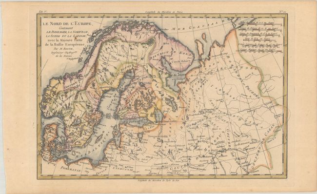
Subject: Northern Europe
Period: 1780 (circa)
Publication: Atlas de Toutes les Parties Connues du Globe Terrestre
Color: Hand Color
Size:
12.8 x 8.4 inches
32.5 x 21.3 cm
Download High Resolution Image
(or just click on image to launch the Zoom viewer)
(or just click on image to launch the Zoom viewer)
Nice map of the region from Lapland to Russia in the north and Denmark to Kazan in the south. Six distance scales balance the title.
References:
Condition: B+
A crisp impression on a lightly toned sheet with a small rust spot in the title.
Estimate: $90 - $110
Current High Bid:
$0
Reserve: Reserve Not Met
Next Bid: $45
Bid Increments
Under $50$1
$50 - $99$5
$100 - $249$10
$250 - $499$25
$500 - $999$50
Terms & Conditions