Current Auction
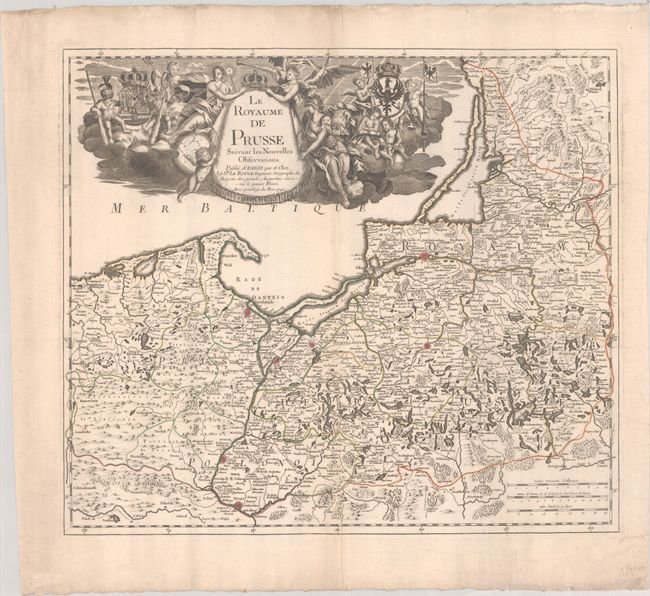
"Le Royaume de Prusse Suivant les Nouvelles Observations", Le Rouge, George Louis
Subject: Baltic
Period: 1742 (dated)
Publication:
Color: Hand Color
Size:
21.6 x 18.9 inches
54.9 x 48 cm
Download High Resolution Image
(or just click on image to launch the Zoom viewer)
(or just click on image to launch the Zoom viewer)
This finely engraved map covers northeastern Poland, the present-day Russian enclave of Kaliningrad Oblast, and western Lithuania. The map is filled with detail and engraved with forests, mountains, and fortified cities. A large allegorical title cartouche fills the Baltic Sea with a vignette of putti and coats of arms floating in the clouds.
References:
Condition: B+
A crisp impression with contemporary outline color on a bright sheet with the watermark of a Maltese cross encircled in rosary beads. There are some extraneous creases and marginal soiling.
Estimate: $350 - $425
Current High Bid:
$0
Reserve: Reserve Not Met
Next Bid: $180
Bid Increments
$100 - $249$10
$250 - $499$25
$500 - $999$50
$1,000 - $2,499$100
Terms & Conditions