Current Auction
"La Curlande Duche et Semigalle Autrefois de la Livonie - La Samogitie Duche en Lituanie", Sanson, Nicolas
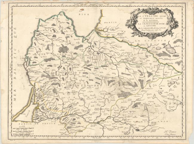
Subject: Baltic, Latvia & Lithuania
Period: 1659 (dated)
Publication: Cartes Generales de Toutes les Parties du Monde
Color: Hand Color
Size:
21.4 x 16.6 inches
54.4 x 42.2 cm
Download High Resolution Image
(or just click on image to launch the Zoom viewer)
(or just click on image to launch the Zoom viewer)
This delicately engraved map shows the historical Latvian lands of Curlande (Courland) and Semigallen (Semigallia), as well as Samogitie (Samogitia) in Lithuania. It spans from Riga south to Vilnius, and from Memel (present-day Klaipeda) east to Braslaw. The top right corner is decorated with an ornate title cartouche complete with cornucopias and putti. Three distance scales appear at bottom left. Engraved by Jean Somer.
References: Pastoureau, SANSON V B [135].
Condition: B
A crisp impression with contemporary outline color on a sheet with a bunch of grapes watermark. There is light dampstaining along the top edge of the map, printer's ink residue, and archival repairs to a tiny centerfold separation at top and to two short edge tears at bottom.
Estimate: $180 - $210
Current High Bid:
$130
Reserve: Reserve Met
Next Bid: $140
Bid Increments
$100 - $249$10
$250 - $499$25
$500 - $999$50
$1,000 - $2,499$100
Terms & Conditions