Current Auction
"Nouvelle Carte Geographique du Royaume de Dannemarck avec une Table des Villes les Plus Remarquables", Chatelain, Henry Abraham
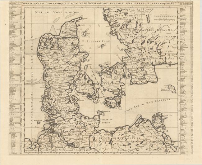
Subject: Denmark & Southern Sweden
Period: 1714 (circa)
Publication: Atlas Historique, Tome IV
Color: Black & White
Size:
23.6 x 19.8 inches
59.9 x 50.3 cm
Download High Resolution Image
(or just click on image to launch the Zoom viewer)
(or just click on image to launch the Zoom viewer)
This map of the Kingdom of Denmark extends to include northern Germany and the southern tip of Sweden. Tables at the sides help locate cities throughout the kingdom.
References: Koeman, Cha 5 #2.
Condition: A
A crisp impression on watermarked paper with a hint of offsetting. There are two tiny fold separations along the top sheet edge that have been closed on verso with archival tape. Issued folding.
Estimate: $200 - $230
Price: $150
Bid Increments
$100 - $249$10
$250 - $499$25
$500 - $999$50
$1,000 - $2,499$100
Terms & Conditions