Current Auction
"Comitatus Zutphaniae et Fluminis Isulae Nova Delineatio", Wit, Frederick de
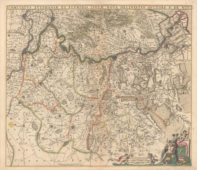
Subject: Eastern Netherlands
Period: 1670 (circa)
Publication:
Color: Hand Color
Size:
21.9 x 19.1 inches
55.6 x 48.5 cm
Download High Resolution Image
(or just click on image to launch the Zoom viewer)
(or just click on image to launch the Zoom viewer)
This detailed early road map follows the Ijssel River from Kampen to Arnhem, with north oriented to the right, and extends east to Enschede. Cities are depicted as miniature fortified plans, and numerous tiny towns are identified among the extensive network of roads. The decorative distance scale cartouche features putti and a river god. This is the second state, with a "G" engraved outside the map at top right.
References: Carhart #123.2.
Condition: B+
A crisp impression with full contemporary color, light toning along the centerfold, a small abrasion within the city of Emmerich, and a tiny hole near the centerfold at the top of the image. There is a short centerfold separation that just passes the neatline at bottom.
Estimate: $240 - $300
Price: $180
Bid Increments
$100 - $249$10
$250 - $499$25
$500 - $999$50
$1,000 - $2,499$100
Terms & Conditions