Current Auction
"Ultraiectum Dominium", Blaeu, Willem
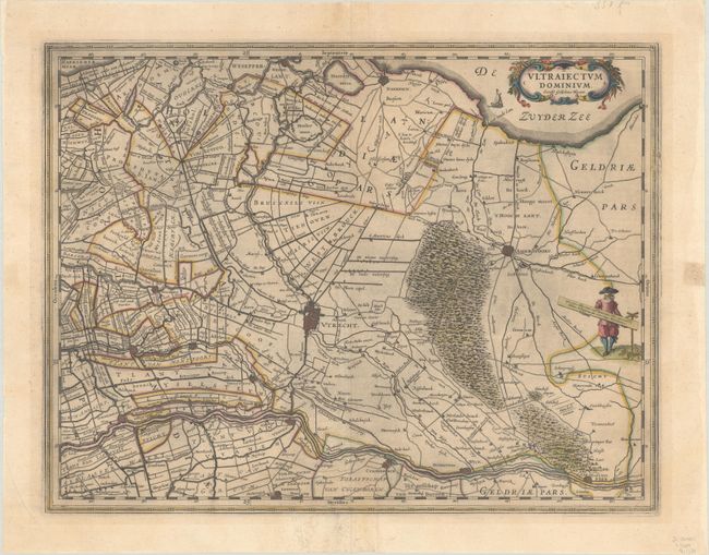
Subject: Central Netherlands
Period: 1647 (circa)
Publication:
Color: Hand Color
Size:
19.5 x 15.2 inches
49.5 x 38.6 cm
Download High Resolution Image
(or just click on image to launch the Zoom viewer)
(or just click on image to launch the Zoom viewer)
Fine map of the immediate vicinity of Utrecht and Amersfoort. The map is a fascinating look at the region during the period of dyke building and lake drainage conducting in Holland in the early 17th century. The map is covered with canals, dykes and windmills. A decorative title cartouche, sailing ship, and a costumed figure supporting the distance scale make this a very attractive sheet. Dutch text on verso, published between 1647-64.
References: Van der Krogt (Vol. II) #3660:2.
Condition: B+
A dark impression with full contemporary color on a sheet with a large watermark of the god Atlas. There is light mat burn, some printer's ink residue, and two small pieces of cello tape on verso, one of which shows through on recto along the right edge of the sheet.
Estimate: $240 - $300
Price: $180
Bid Increments
$100 - $249$10
$250 - $499$25
$500 - $999$50
$1,000 - $2,499$100
Terms & Conditions