Current Auction
"Partie Meridionale des Pays Bas, Comprenant les Provinces de Brabant, Gueldre, Limbourg, Luxembourg, Haynaut,Namur, Flandre, Cambresis et Artois", Janvier/Lattre
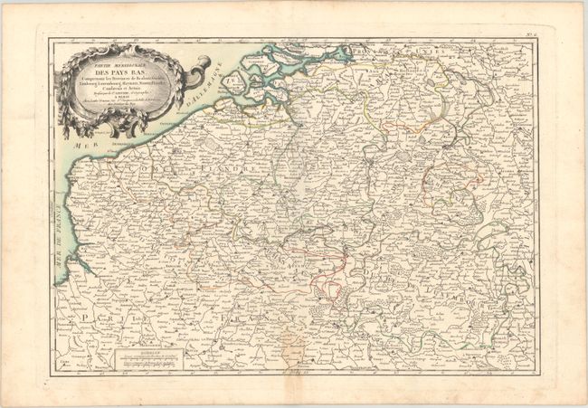
Subject: Belgium & Luxembourg
Period: 1762 (published)
Publication: Atlas Moderne
Color: Hand Color
Size:
17.6 x 12.1 inches
44.7 x 30.7 cm
Download High Resolution Image
(or just click on image to launch the Zoom viewer)
(or just click on image to launch the Zoom viewer)
Very detailed and well-engraved map of the region extending to include parts of France and The Netherlands. Rococo-style cartouche and two distant scales.
References:
Condition: B+
A nice impression with contemporary color, marginal soiling, a light dampstain along the centerfold at bottom, and a few small worm holes in the bottom margin.
Estimate: $80 - $95
Price: $60
Bid Increments
Under $50$1
$50 - $99$5
$100 - $249$10
$250 - $499$25
$500 - $999$50
Terms & Conditions