Current Auction
"Gallia Postarum Geographice Designata, in qua Cursus Postarum Secundum Statum Anni 1738...", Homann Heirs
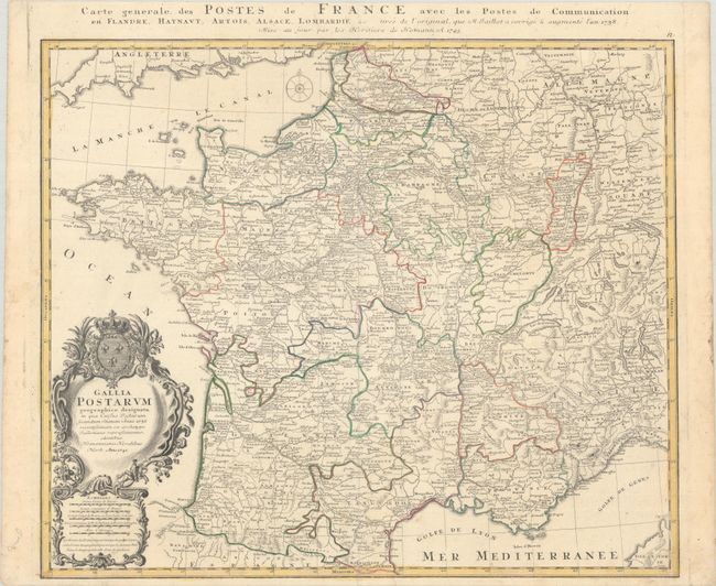
Subject: France
Period: 1745 (dated)
Publication:
Color: Hand Color
Size:
22.4 x 18.9 inches
56.9 x 48 cm
Download High Resolution Image
(or just click on image to launch the Zoom viewer)
(or just click on image to launch the Zoom viewer)
This is an extremely detailed map showing all the postal routes and offices throughout France. The map was originally drawn in 1738 by Jaillot and updated here by the Homann firm. The large decorative title cartouche includes two postmen galloping on their trusty steeds. An additional title is in the top margin: "Carte generale des Postes de France avec les Postes de Communication en Flandre, Haynaut, Artois, Alsace, Lombardie &c."
References:
Condition: A
A nice impression with contemporary outline color on a bright sheet with the watermarks of Elias Kutter and a fleur-de-lis. There is a minor abrasion by the mouth of the Loire River and a short centerfold separation at bottom that has been closed on verso with archival tape.
Estimate: $130 - $160
Price: $95
Bid Increments
$50 - $99$5
$100 - $249$10
$250 - $499$25
$500 - $999$50
Terms & Conditions