Current Auction
"La Souverainete de Sedan et de Ravcourt, et la Prevoste de Doncheri", Jansson/Valck & Schenk
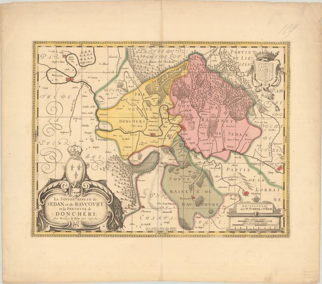
Subject: Northern France
Period: 1700 (circa)
Publication:
Color: Hand Color
Size:
19.5 x 14.8 inches
49.5 x 37.6 cm
Download High Resolution Image
(or just click on image to launch the Zoom viewer)
(or just click on image to launch the Zoom viewer)
Lovely map centered on Sedan and Doncheri and the Meuze River from Charleville and Mezieres to Mosuon and Yvoy. The fortified cities are well depicted. Richly embellished with a large title cartouche with the royal arms, a scale cartouche and coat of arms. The imprint of Melchoir Tavernier is at bottom center. This map was first published by Henricus Hondius, then Jan Jansson with his imprint replacing that of Hondius, and finally by Valck & Schenk, who added a graticule and their own imprint. Blank verso.
References: cf. Van der Krogt (Vol. I) #4220:1.2.
Condition: A
A sharp impression with full contemporary color on a bright sheet with minor toning along the centerfold and two small worm holes in the bottom margin.
Estimate: $140 - $170
Price: $100
Bid Increments
$50 - $99$5
$100 - $249$10
$250 - $499$25
$500 - $999$50
Terms & Conditions