Current Auction
"La Bresse, le Bugey, le Valromay, la Principaute de Dombes et le Viennois", Dezauche, J. A.
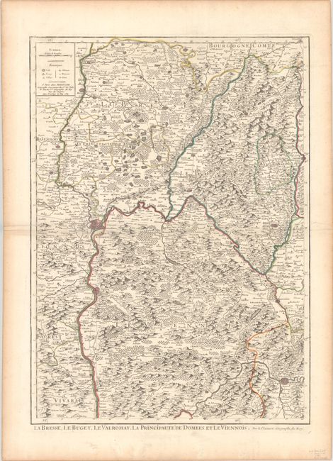
Subject: Eastern France
Period: 1784 (dated)
Publication:
Color: Hand Color
Size:
18.3 x 25.3 inches
46.5 x 64.3 cm
Download High Resolution Image
(or just click on image to launch the Zoom viewer)
(or just click on image to launch the Zoom viewer)
This densely engraved map depicts the mountainous region surrounding Lyon, extending to include the cities of Grenoble and St. Claude. Larger cities are shown as fortified plans, and hundreds of tiny towns are identified, with early roads and graphic mountains filling the map. The map was prepared by Jaillot and reissued by Dezauche.
References:
Condition: A
A nice impression with contemporary outline color on a sheet with a large watermark of a Maltese cross encircled in rosary beads. There is light toning and soiling along the edges of the sheet.
Estimate: $80 - $100
Price: $60
Bid Increments
Under $50$1
$50 - $99$5
$100 - $249$10
$250 - $499$25
$500 - $999$50
Terms & Conditions