Current Auction
"Legionis, Biscaiae et Guipiscoae Typus", Mercator/Hondius
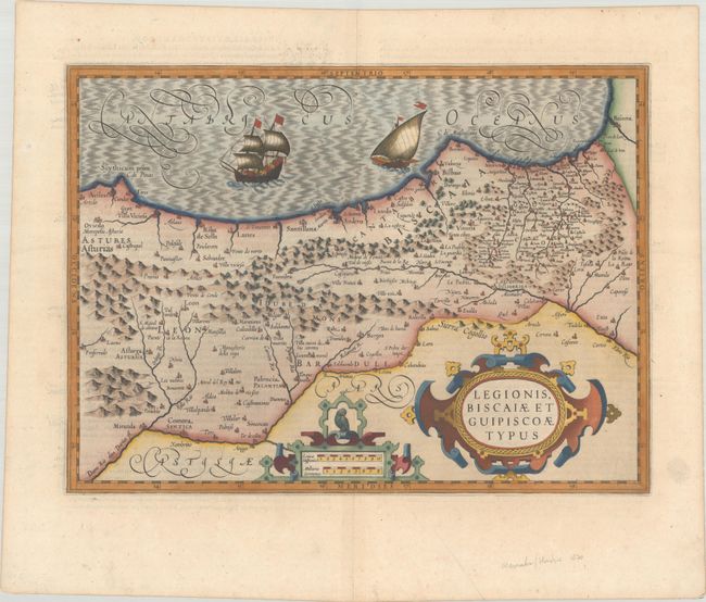
Subject: Northern Spain
Period: 1613 (circa)
Publication: Gerardi Mercatoris - L'Atlas ou Meditations Cosmographiques
Color: Hand Color
Size:
18.6 x 13.7 inches
47.2 x 34.8 cm
Download High Resolution Image
(or just click on image to launch the Zoom viewer)
(or just click on image to launch the Zoom viewer)
This handsome map shows the Province of Cantabria, from the Pyrenees in the east to the Province of Asturia in the west. The map is adorned with two sailing ships in the Bay of Biscay and two strapwork cartouches. French text on verso, published between 1613-16.
References: Van der Krogt (Vol. I) #6010:1A.
Condition: A
A sharp impression on a bright sheet with the watermark of Marten Orges. There is minor marginal soiling and a pair of printer's creases at bottom center.
Estimate: $275 - $350
Price: $200
Bid Increments
$100 - $249$10
$250 - $499$25
$500 - $999$50
$1,000 - $2,499$100
Terms & Conditions