Current Auction
"Reyno de Arragon", Tassin, Christophe Nicholas
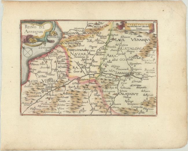
Subject: Northeastern Spain
Period: 1651 (published)
Publication: Cartes Generales des Provinces de France et d'Espagne
Color: Hand Color
Size:
5.9 x 4.2 inches
15 x 10.7 cm
Download High Resolution Image
(or just click on image to launch the Zoom viewer)
(or just click on image to launch the Zoom viewer)
This rare small map depicts the region around Pamplona and Zaragoza, extending to the Bay of Biscay and the border with France. The map is oriented with north to the top left of the sheet and is adorned with a decorative title cartouche and a ribbon-style distance scale. According to Pastoureau, the map was likely engraved by H. Picart. Published by Nicolas Berey.
References: Pastoureau, TASSIN III D.
Condition: A
A nice impression with minor marginal soiling.
Estimate: $110 - $140
Price: $80
Bid Increments
$50 - $99$5
$100 - $249$10
$250 - $499$25
$500 - $999$50
Terms & Conditions