Current Auction
"Vindeliciae et Norici, Conterminarumq Terrarum Antiqua Descriptio", Cluver, Philipp
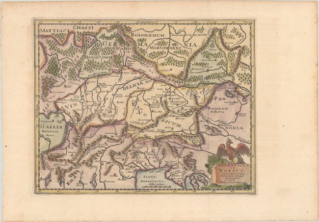
Subject: Central Europe
Period: 1729 (published)
Publication: Introductionis in Universam Geographiam
Color: Hand Color
Size:
10.1 x 8 inches
25.7 x 20.3 cm
Download High Resolution Image
(or just click on image to launch the Zoom viewer)
(or just click on image to launch the Zoom viewer)
This historical map shows an important region of the old Roman Empire, covering parts of Germany, Austria, Switzerland, Hungary and Italy. It centers roughly on the important Danube River, which flows across the map. The title cartouche is surmounted by a royal eagle.
Cluver's Introductio in Universam Geographicam was a popular atlas, appearing in over 45 editions during a 100-year period. The first edition was published without maps in the 1620s, and the first edition to include maps was published circa 1641. The various editions were published in different cities throughout Europe, including Amsterdam, Nuremberg, and London, often with new sets of maps engraved. This map is from an edition published in Amsterdam by Joannem Pauli with maps by Jan Wolters.
References: Shirley (BL Atlases) T.CLUV-8b.
Condition: A
A crisp impression, issued folding on a sheet with a "K K" watermark and minor marginal foxing.
Estimate: $110 - $140
Price: $80
Bid Increments
$50 - $99$5
$100 - $249$10
$250 - $499$25
$500 - $999$50
Terms & Conditions