Current Auction
"Potentia Archiducum Austriae sive Circuli Austriaci Delineatio, qua Illius Fines Hodierni Graphice et Accurate Exhibentur", Lotter, Tobias Conrad
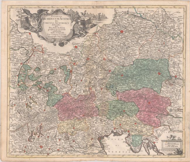
Subject: Central Europe
Period: 1760 (circa)
Publication:
Color: Hand Color
Size:
22.5 x 19.1 inches
57.2 x 48.5 cm
Download High Resolution Image
(or just click on image to launch the Zoom viewer)
(or just click on image to launch the Zoom viewer)
This highly detailed map covers central Europe from Mainz, Nurnberg and Prag in the north to Milan and the Gulf of Venice in the south. The map depicts fortified cities, hundreds of tiny towns, and early roads. Adorned with a distance scale decorated with a putto with measuring dividers and an elaborate title cartouche that features symbols of agriculture, trade, and the arts and sciences.
References:
Condition: B+
A nice impression with full contemporary color on a bright sheet with an extraneous horizontal fold and an old paper repair in the right margin on recto that obscures a portion of the neatline.
Estimate: $240 - $300
Price: $180
Bid Increments
$100 - $249$10
$250 - $499$25
$500 - $999$50
$1,000 - $2,499$100
Terms & Conditions