Current Auction
"Meklenburg Ducatus Auctore Ioanne Laurenbergio", Jansson, Jan
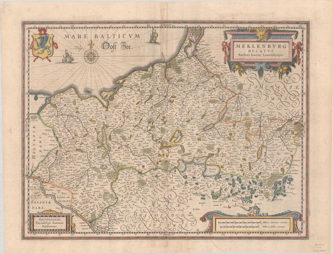
Subject: Northeastern Germany
Period: 1638 (circa)
Publication: Nieuwen Atlas
Color: Hand Color
Size:
18.8 x 14.4 inches
47.8 x 36.6 cm
Download High Resolution Image
(or just click on image to launch the Zoom viewer)
(or just click on image to launch the Zoom viewer)
Johan Laurenberg's attractive map of the northeastern part of Germany was originally produced by Jodocus Hondius shortly before his death and engraved by S. Rogiers. After the plate was sold to Willem Blaeu in 1629, Jansson engraved a copy of the plate to use in his own atlases to compete with Blaeu. The map is filled with place names and decorated with three cartouches, a coat of arms, two sailing ships and a compass rose. Dutch text on verso, published between 1638-44.
References: Van der Krogt (Vol. I) #2210:1.1.
Condition: B+
A nice impression with light soiling and some extraneous creasing along the centerfold. There is an archivally repaired centerfold separation at bottom.
Estimate: $140 - $170
Price: $100
Bid Increments
$50 - $99$5
$100 - $249$10
$250 - $499$25
$500 - $999$50
Terms & Conditions