Current Auction
"S.R.I. Principatus Fuldensis in Buchonia cum Adjacentibus Quibusdam Regionibus Adumbratus", Homann, Johann Baptist
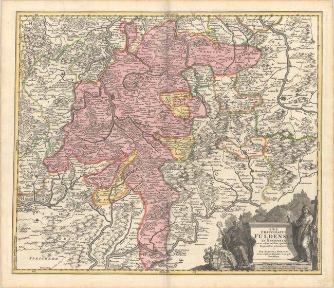
Subject: Central Germany
Period: 1716 (circa)
Publication: Grosser Atlas
Color: Hand Color
Size:
22.5 x 19 inches
57.2 x 48.3 cm
Download High Resolution Image
(or just click on image to launch the Zoom viewer)
(or just click on image to launch the Zoom viewer)
This brilliant map shows the diocese of Fulda in central Germany and shows the numerous rivers, forests and mountains of the area. The title cartouche portrays the Benedictine Abbey atop Mount St. Peter, built circa 800, and two saints.
References:
Condition: A+
A sharp impression with full contemporary color on a bright sheet with a coat of arms watermark and a hint of marginal soiling.
Estimate: $200 - $230
Price: $150
Bid Increments
$100 - $249$10
$250 - $499$25
$500 - $999$50
$1,000 - $2,499$100
Terms & Conditions