Current Auction
"Circuli Franconiae Pars Orientalis et Potior Novissime Delineata...", Homann, Johann Baptist
Subject: Southeastern Germany
Period: 1716 (published)
Publication:
Color: Hand Color
Size:
19.1 x 21.7 inches
48.5 x 55.1 cm
Download High Resolution Image
(or just click on image to launch the Zoom viewer)
(or just click on image to launch the Zoom viewer)
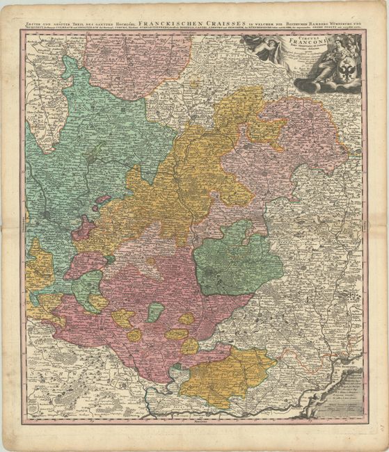
A finely detailed map centered on Bamberg, Nuremberg, and Wurtzburg, the Bavarian region of southeast Germany. It shows towns, fortresses, monasteries, roads, forests, lakes, and rivers. The title cartouche includes putti and Roman heraldry. Another cherub presents the scale and key cartouche. Alternate German title runs above the upper neatline: Oberer und Groster Theil des Gantzen Hochlobl: Franckischen Craisses, in Welchem die Bistumer Bamberg, Wurtzburg und Aichstet.
References:
Condition: A
A sharp impression with full contemporary color, minor toning along the centerfold at right, a small worm track in the right margin, and a short centerfold separation at right that has been closed on verso with archival tape.
Estimate: $100 - $130
Price: $75
Bid Increments
$50 - $99$5
$100 - $249$10
$250 - $499$25
$500 - $999$50
Terms & Conditions