Current Auction
"America", Thomson, John
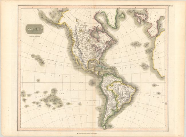
Subject: Western Hemisphere - America
Period: 1813 (circa)
Publication: New General Atlas
Color: Hand Color
Size:
23.7 x 19.8 inches
60.2 x 50.3 cm
Download High Resolution Image
(or just click on image to launch the Zoom viewer)
(or just click on image to launch the Zoom viewer)
In Thomson's style, this well engraved map shows the latest discoveries including those of Mackenzie, Hearne, and Lewis & Clark. The map extends to include the coasts of Europe and West Africa, and it presents good detail of islands in the eastern portion of the South Pacific. The United States is shown north of East and West Florida, and east of the Mississippi River. The land west of the Mississippi is labeled Louisiana and the northwest portion of the continent contains limited detail. Hawaii is Sandwich Isles and Aliaska is in a rudimentary shape.
References: Phillips (Atlases) #731-52.
Condition: B+
Contemporary color with faint toning along the centerfold. A short fold separation at bottom and a few small edge tears have all been closed on verso with archival tape.
Estimate: $180 - $220
Current High Bid:
$0
Reserve: Reserve Not Met
Next Bid: $90
Bid Increments
$50 - $99$5
$100 - $249$10
$250 - $499$25
$500 - $999$50
Terms & Conditions