Current Auction
"Daciarum Moesiarum et Thraciae Vetus et Nova Descriptio", Cluver, Philipp
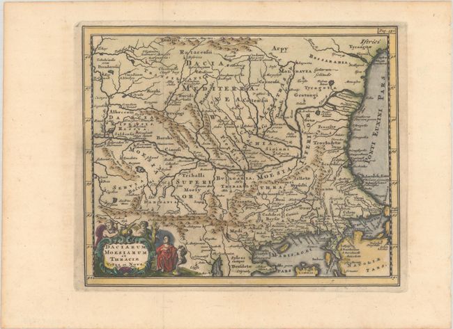
Subject: Romania & Bulgaria
Period: 1729 (published)
Publication: Introductionis in Universam Geographiam
Color: Hand Color
Size:
9.7 x 8 inches
24.6 x 20.3 cm
Download High Resolution Image
(or just click on image to launch the Zoom viewer)
(or just click on image to launch the Zoom viewer)
Appealing small map of the area of Romania and Bulgaria centered on the Danube River, decorated with an allegorical strapwork cartouche.
Cluver's Introductio in Universam Geographicam was a popular atlas, appearing in over 45 editions during a 100-year period. The first edition was published without maps in the 1620s, and the first edition to include maps was published circa 1641. The various editions were published in different cities throughout Europe, including Amsterdam, Nuremberg, and London, often with new sets of maps engraved. This map is from an edition published in Amsterdam by Joannem Pauli with maps by Jan Wolters.
References: Shirley (BL Atlases) T.CLUV-8b.
Condition: A
A dark impression, issued folding on a sheet with a hint of offsetting.
Estimate: $110 - $140
Price: $80
Bid Increments
$50 - $99$5
$100 - $249$10
$250 - $499$25
$500 - $999$50
Terms & Conditions