Current Auction
"Amerique Septentrionale Divisee en ses Regions et Principaux Peuples"
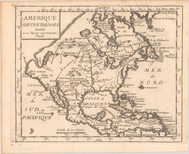
Subject: Colonial North America
Period: 1741 (circa)
Publication:
Color: Black & White
Size:
7.2 x 5.9 inches
18.3 x 15 cm
Download High Resolution Image
(or just click on image to launch the Zoom viewer)
(or just click on image to launch the Zoom viewer)
This fascinating small map appeared in several geography books by Nicolas Lenglet-Dufresnoy in the mid-18th century. It presents an unusual configuration for the northwest coast of North America, running diagonally from California to Husdon Bay. The Sea of the West connects to a river flowing east, nearly intersecting with a remnant of Lanhotan's R. Longue. New England is confined to the eastern seaboard, where only a few place names are noted, including Boston, New York, Jamestown and Charleston. An interesting and uncommon map.
References: McGuirk #12.
Condition: A
A nice impression, issued folding on a watermarked sheet with a hint of offsetting and a tiny fold separation in the bottom margin.
Estimate: $240 - $300
Current High Bid:
$120
Reserve: Reserve Not Met
Next Bid: $130
Bid Increments
$100 - $249$10
$250 - $499$25
$500 - $999$50
$1,000 - $2,499$100
Terms & Conditions