Current Auction
NO RESERVE
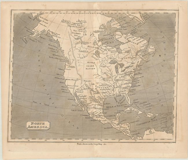
"North America", Anon.
Subject: North America
Period: 1805 (circa)
Publication:
Color: Black & White
Size:
9.5 x 7.5 inches
24.1 x 19.1 cm
Download High Resolution Image
(or just click on image to launch the Zoom viewer)
(or just click on image to launch the Zoom viewer)
This anonymous small map is based upon Aaron Arrowsmith's large map of North America issued in 1802. It shows the United States extending to the Mississippi River with a large Louisiana and New Mexico to its west. The map is pre-Lewis & Clark with several possible Missouri River tributaries stopping just short of the Rocky Mountains, which extend far into northern Canada. Alaska is still in a rudimentary form and notations in far northern Canada indicate the sea was seen by Hearn (1771) and MacKenzie (1789).
References:
Condition: B
A nice impression with scattered foxing.
Estimate: $80 - $100
Current High Bid:
$36
Reserve: Reserve Met
Next Bid: $37
Bid Increments
Under $50$1
$50 - $99$5
$100 - $249$10
$250 - $499$25
$500 - $999$50
Terms & Conditions