Current Auction
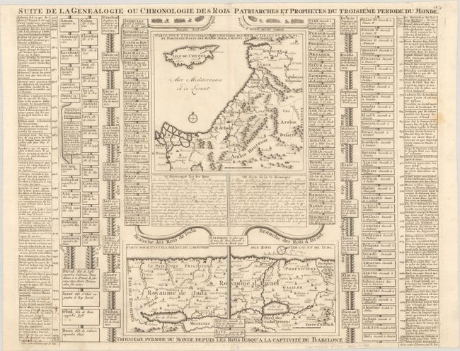
"Suite de la Genealogie ou Chronologie des Rois Patriarches et Prophetes du Troisieme Periode du Monde", Chatelain, Henry Abraham
Subject: Holy Land
Period: 1720 (circa)
Publication: Atlas Historique
Color: Black & White
Size:
18.8 x 15.2 inches
47.8 x 38.6 cm
Download High Resolution Image
(or just click on image to launch the Zoom viewer)
(or just click on image to launch the Zoom viewer)
This intriguing folio sheet contains two maps of the Holy Land with text and family trees describing the region during Biblical times. The upper map shows the region from Alexandrie and Antioche in present-day Syria to the Nile Delta and includes Cyprus and part of the Arabian desert. The bottom map focuses on Palestine with north oriented to the right.
References: Laor #211.
Condition: B+
A crisp impression on a bright sheet with a small fleur-de-lis watermark, a couple of faint stains at far right, a small chip at bottom center, and an extraneous horizontal crease. There is some show-through at bottom left of old manuscript ink notations on verso.
Estimate: $100 - $130
Current High Bid:
$50
Reserve: Reserve Not Met
Next Bid: $55
Bid Increments
$50 - $99$5
$100 - $249$10
$250 - $499$25
$500 - $999$50
Terms & Conditions