Current Auction
"Carte de la Georgie &c. des Pays Situes Entre la Mer Noire et la Mer Caspienne...", Santini, P.
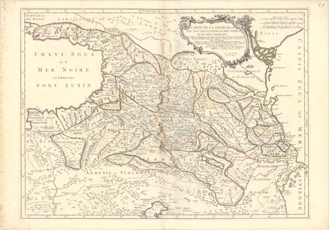
Subject: Caucasus
Period: 1766 (circa)
Publication:
Color: Hand Color
Size:
26.2 x 19.1 inches
66.5 x 48.5 cm
Download High Resolution Image
(or just click on image to launch the Zoom viewer)
(or just click on image to launch the Zoom viewer)
Striking, large-scale map of the area between the Black and Caspian Seas displays political divisions and delicately engraved topography. It is based on a 1766 map by Joseph Nicholas Delisle, as credited in the ornate cartouche. There are two gold mines noted just south of Trabzon (Trapizoni).
References:
Condition: B+
A crisp impression with contemporary outline color on a bright sheet with the watermark of three stars. There is very light toning and offsetting along the centerfold, as well as foxing almost entirely confined to the left margin.
Estimate: $300 - $375
Current High Bid:
$220
Reserve: Reserve Met
Next Bid: $230
Bid Increments
$100 - $249$10
$250 - $499$25
$500 - $999$50
$1,000 - $2,499$100
Terms & Conditions