Current Auction
"Asie", Tassin, Christophe Nicholas
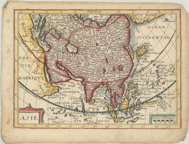
Subject: Asia
Period: 1651 (published)
Publication: Carte Generalle de la Geographie Royalle
Color: Hand Color
Size:
7.6 x 5.4 inches
19.3 x 13.7 cm
Download High Resolution Image
(or just click on image to launch the Zoom viewer)
(or just click on image to launch the Zoom viewer)
This rare little map is a close copy of Jan Jansson's map of Asia that was published in Atlas Minor between 1628-51 and was engraved by Abraham Goos. Korea appears as an island named Corea, an exaggerated Gulf of Cambay distorts the Indian subcontinent, and only the northern coastline of New Guinea is shown. In the extreme east is Partie d'Amerique and a small island named I. le Paxaras. According to Pastoureau, the map was likely engraved by H. Picart. Published by Nicolas Berey.
References: Pastoureau, TASSIN I A [5].
Condition: B+
A sharp impression on a sheet with a bunch of grapes watermark, light soiling, and a small worm hole in the Indian Ocean. There are binding holes and small chips along the edges of the sheet.
Estimate: $140 - $170
Current High Bid:
$0
Reserve: Reserve Not Met
Next Bid: $70
Bid Increments
$50 - $99$5
$100 - $249$10
$250 - $499$25
$500 - $999$50
Terms & Conditions