Current Auction
"North America Drawn & Engraved for Dr. Playfairs Geography", Playfair, James
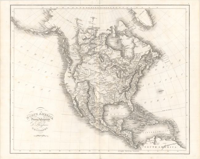
Subject: North America
Period: 1814 (circa)
Publication: A New General Atlas, Ancient and Modern...
Color: Black & White
Size:
21.1 x 17.6 inches
53.6 x 44.7 cm
Download High Resolution Image
(or just click on image to launch the Zoom viewer)
(or just click on image to launch the Zoom viewer)
A detailed map of the continent showing the United States confined to east of the Mississippi River with a large Louisiana Territory extending into New Mexico. Issued shortly before the Lewis & Clark findings, the west features an elaborate network of mountains and rivers on the eastern slopes of the Rocky Mountains, including the three forks of the Missouri River (Galatin, Madison, and Jefferson). The region of present-day California and Oregon is almost entirely void of inland detail with numerous missions named along the coast. In the Arctic, the discoveries of MacKenzie and Hearne are noted, and Alaska's outline is relatively accurate. Engraved by Samuel Neele.
References:
Condition: B+
A nice impression on a bright sheet with light foxing and short centerfold separations at top and bottom that have been closed with archival tape.
Estimate: $400 - $475
Current High Bid:
$200
Reserve: Reserve Not Met
Next Bid: $210
Bid Increments
$100 - $249$10
$250 - $499$25
$500 - $999$50
$1,000 - $2,499$100
Terms & Conditions