Current Auction
"Nouvelle Description d Afrique", Tassin, Christophe Nicholas
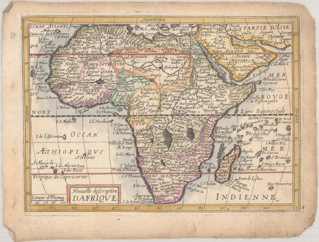
Subject: Africa
Period: 1651 (published)
Publication: Carte Generalle de la Geographie Royale
Color: Hand Color
Size:
7.4 x 5.3 inches
18.8 x 13.5 cm
Download High Resolution Image
(or just click on image to launch the Zoom viewer)
(or just click on image to launch the Zoom viewer)
Fine small map of Africa, which is copied from Jan Jansson's Atlas Minor map, which itself was based largely on the work of Hernicus Hondius. The map is filled with place names and the Nile is shown with its source in the Ptolemaic twin lakes of Zaire and Zaflan. Published by Nicolas Berey.
See also lot 788 for Richard Betz's The Mapping of Africa - A Cartobibliography of Printed Maps of the African Continent to 1700 that describes this map.
References: Betz #81; Pastoureau, TASSIN I A [4].
Condition: B+
A crisp impression with a small worm hole in the Atlantic, light soiling, and light toning along the edges of the sheet. There are chips in the corners of the sheet, not affecting the image.
Estimate: $160 - $190
Current High Bid:
$100
Reserve: Reserve Not Met
Next Bid: $110
Bid Increments
$100 - $249$10
$250 - $499$25
$500 - $999$50
$1,000 - $2,499$100
Terms & Conditions