Current Auction
NO RESERVE
"L'Afrique Divisee en ses Principaux Etats", Janvier/Lattre
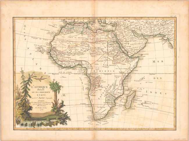
Subject: Africa
Period: 1762 (dated)
Publication: Atlas Moderne
Color: Hand Color
Size:
17.2 x 12 inches
43.7 x 30.5 cm
Download High Resolution Image
(or just click on image to launch the Zoom viewer)
(or just click on image to launch the Zoom viewer)
This excellent copper engraved map of the continent shows the extent of European geographical knowledge in the mid 18th century. While mostly accurate, it does have remnants of fantasy such as the twin lake source of the Nile in the Mts de la Lune, which in this depiction is quite a bit north of the Equator. C. de Bonne Esperance and Stellembos Pic are the only settlements marked in southern Africa, which is occupied by the Hottentots tribes. The pictorial title cartouche features a waterfall, pine trees, a leopard, and a crocodile.
References: Norwich #104.
Condition: B
Contemporary outline color with light offsetting, toning along the centerfold, and minor foxing.
Estimate: $80 - $100
Current High Bid:
$38
Reserve: Reserve Met
Next Bid: $39
Bid Increments
Under $50$1
$50 - $99$5
$100 - $249$10
$250 - $499$25
$500 - $999$50
Terms & Conditions