Current Auction
"Africa, from the Best Authorities", Kitchin, Thomas
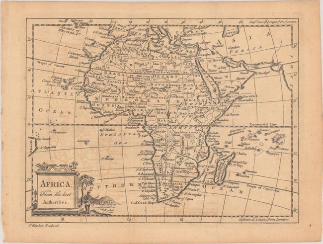
Subject: Africa
Period: 1774 (circa)
Publication:
Color: Black & White
Size:
9.4 x 7.1 inches
23.9 x 18 cm
Download High Resolution Image
(or just click on image to launch the Zoom viewer)
(or just click on image to launch the Zoom viewer)
This interesting and uncommon late 18th century map of Africa shows good detail both along the coastlines as well as in the interior. Most regions are named including Cafreria, Hottentots, Nubia, and the Sahara, here labeled Zaara or the Desart. The twin lakes of Zaflan and Zaire appear just below the equator, but neither is identified as the source of the Nile. The map stretches to include the eastern tip of South America, as well as parts of Europe and Asia, but these areas are largely left blank. A decorative plinth title cartouche at bottom left features a native with bow and arrow.
References:
Condition: B
Issued folding with light toning and offsetting.
Estimate: $110 - $140
Current High Bid:
$0
Reserve: Reserve Not Met
Next Bid: $55
Bid Increments
$50 - $99$5
$100 - $249$10
$250 - $499$25
$500 - $999$50
Terms & Conditions