Current Auction
NO RESERVE
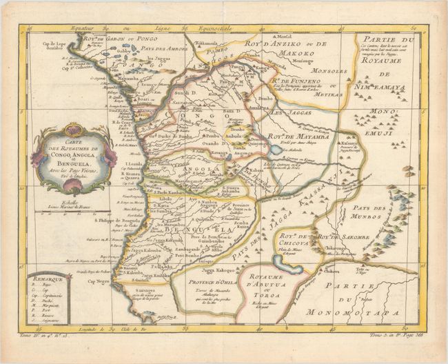
"Carte des Royaumes de Congo, Angola, et Benguela, avec les Pays Voisins, Tire de l'Anglois", Bellin, Jacques Nicolas
Subject: Western Africa
Period: 1760 (circa)
Publication: Histoire Generale des Voyages
Color: Hand Color
Size:
12.4 x 9.4 inches
31.5 x 23.9 cm
Download High Resolution Image
(or just click on image to launch the Zoom viewer)
(or just click on image to launch the Zoom viewer)
This elegantly engraved and nicely detailed map shows present-day Gabon, Congo, and Angola. Several towns and cities are named, contemporary political divisions are delineated, and several rivers are traced. A road spans from Luanda to Kamga M on the Congo River. Notes in French text indicate speechless tribes, an area destroyed by the Portuguese, silver mines, and more. A key at bottom left identifies abbreviations used in the map. The title is contained in an ornate cartouche.
References:
Condition: A
A nice impression issued folding, now flat, on watermarked paper. There is minor offsetting and marginal toning.
Estimate: $100 - $130
Current High Bid:
$26
Reserve: Reserve Met
Next Bid: $27
Bid Increments
Under $50$1
$50 - $99$5
$100 - $249$10
$250 - $499$25
$500 - $999$50
Terms & Conditions