Current Auction
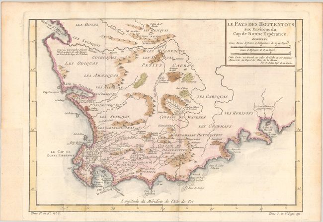
"Le Pays des Hottentots aux Environs du Cap de Bonne Esperance", Bellin, Jacques Nicolas
Subject: Southern Africa
Period: 1757 (published)
Publication: Histoire Generale des Voyages
Color: Hand Color
Size:
13.8 x 9.8 inches
35.1 x 24.9 cm
Download High Resolution Image
(or just click on image to launch the Zoom viewer)
(or just click on image to launch the Zoom viewer)
A beautifully engraved copperplate map of the Cape of Good Hope from Saint Helena Bay to Mossel Bay. Dutch settlements are mostly confined along the coast and southern regions. The inland regions are depicted as deserts, savannas, forests and mountain ranges with tribal names indicated and a few Boer colonies.
References:
Condition: A
A nice impression, issued folding on a watermarked sheet with faint offsetting and light toning along the edges of the sheet. A binding trim at left has been replaced with old paper.
Estimate: $80 - $95
Current High Bid:
$0
Reserve: Reserve Not Met
Next Bid: $40
Bid Increments
Under $50$1
$50 - $99$5
$100 - $249$10
$250 - $499$25
$500 - $999$50
Terms & Conditions