Current Auction
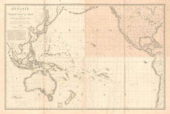
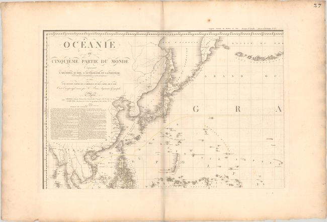
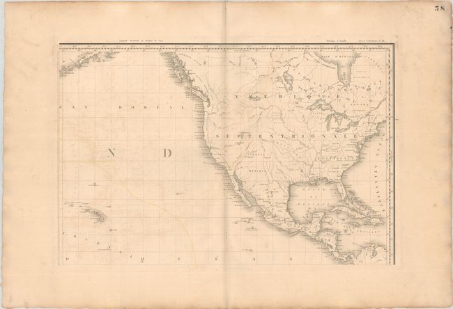
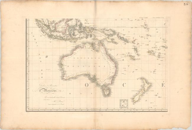
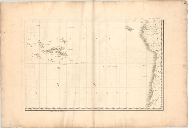
Wall-Sized Map of the Pacific Ocean in Four Sheets
"[On 4 Sheets] Oceanie ou Cinquieme Partie du Monde Comprenant l'Archipel d'Asie, l'Australasie et la Polynesie...", Brue, Adrien Hubert
Subject: Pacific Ocean
Period: 1817 (dated)
Publication: Atlas Universel
Color: Hand Color
Size:
29.1 x 19.2 inches
73.9 x 48.8 cm
Download High Resolution Image
(or just click on image to launch the Zoom viewer)
(or just click on image to launch the Zoom viewer)
This mammoth four-sheet map of the Pacific Ocean gives excellent detail of the numerous islands in the Pacific as well as the surrounding continents. North America is shown nearly in full, with the extensive network of rivers and lakes depicted. Present-day United States is divided into Etats-Unis, Louisiane, and Nouveau Mexique. Only a few states and cities are identified, primarily along the East Coast. In Asia, detail is confined to the coasts, and the numerous islands throughout Southeast Asia are well depicted and labeled. In the South Pacific, New Guinea is still only partially delineated, and the southern coastline is quite rudimentary. The coastline of Australia (Nouvelle Hollande) is complete and there is an abundance of information along the coasts, based in part on an expedition to Australia led by Nicolas Baudin from 1800-1803, which Brue accompanied as a teenager. The only inland detail is a small portion of the Blue Mountains based on the 1813 expedition of Gregory Blaxland, William Lawson, and William Charles Wentworth. A small inset adjacent to New Zealand depicts the islands to the south. Below the title is an analysis of the sources of the chart listed by geographic region, including Freycinet, Flinders, Arrowsmith, d'Anville, Dalrymple, Vancouver, la Perouse, and many others. If joined, the map would measure approximately 58 x 38".
References:
Condition: B
Contemporary outline color with light foxing and offsetting. The southeastern sheet has some light creasing. There are minor chips and tears along the sheet edges far from the images. The first image is a composite image - the map is on four separate sheets.
Estimate: $1,100 - $1,400
Current High Bid:
$0
Reserve: Reserve Not Met
Next Bid: $550
Bid Increments
$500 - $999$50
$1,000 - $2,499$100
$2,500 - $4,999$250
$5,000 - $9,999$500
Terms & Conditions