Current Auction
"New Holland and Asiatic Isles", Thomson, John
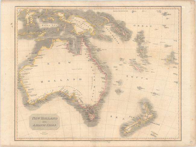
Subject: Australia & New Zealand
Period: 1814 (dated)
Publication: Thomson's New General Atlas
Color: Hand Color
Size:
24.4 x 19.8 inches
62 x 50.3 cm
Download High Resolution Image
(or just click on image to launch the Zoom viewer)
(or just click on image to launch the Zoom viewer)
A large map of the Australasia region, presenting Australia with a completed southern coastline, which was "Discovered by Capt. Flinders 1802" and Discovd. by Capt. Grant 1800." There is good coastal detail on most of the Australia, though the interior is virtually blank. The map extends to include New Zealand, the Solomon Islands, New Guinea, and more.
References:
Condition: B+
A nice impression with minor toning, faint creasing adjacent to the centerfold, and a short archivally repaired fold separation at bottom.
Estimate: $300 - $375
Current High Bid:
$0
Reserve: Reserve Not Met
Next Bid: $150
Bid Increments
$100 - $249$10
$250 - $499$25
$500 - $999$50
$1,000 - $2,499$100
Terms & Conditions