Current Auction
"Amerique Septentrionale", Levasseur, Victor
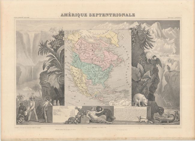
Subject: North America, Texas
Period: 1861 (published)
Publication: Atlas Universel Illustre
Color: Hand Color
Size:
17.3 x 11.2 inches
43.9 x 28.4 cm
Download High Resolution Image
(or just click on image to launch the Zoom viewer)
(or just click on image to launch the Zoom viewer)
Victor Levasseur's "Atlas National Illustre" and "Atlas Universel Illustre" are among the last decorative atlases published. The maps are all lavishly illustrated with scenes of the countryside, products and activities indigenous to the region.
Despite its publication date, this richly engraved map of North America retains some of the more interesting cartographic features from the 1840s, including the United States' claims into present-day Canada reflecting the Oregon boundary dispute. The Republic of Texas is shown in its smaller configuration, and Mexico's northern border is drawn according to the Treaty of 1819 (here misprinted as 1810). Russia is in control of Alaska. The map is surrounded by beautifully engraved scenes of North and Central America including wildlife, a ship stranded in the polar sea and a Mayan temple.
References:
Condition: B+
Contemporary color with some minor foxing mostly in the margins.
Estimate: $150 - $180
Current High Bid:
$0
Reserve: Reserve Not Met
Next Bid: $75
Bid Increments
$50 - $99$5
$100 - $249$10
$250 - $499$25
$500 - $999$50
Terms & Conditions