Current Auction
Second Volume of Blaeu's Atlas Featuring Maps of the Americas and Asia
"Toonneel des Aerdrycx, oft Nieuwe Atlas ... Tweede Deel", Blaeu, (Family)
Subject: Atlases
Period: 1642 (published)
Publication:
Color: Black & White
Size:
13.5 x 20 inches
34.3 x 50.8 cm
Download High Resolution Image
(or just click on image to launch the Zoom viewer)
(or just click on image to launch the Zoom viewer)
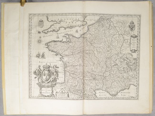
This is a Dutch edition of Volume 2 of Blaeu's Theatrum Orbis Terrarum, which includes 89 maps (out of 92). The Theatrum Orbis Terrarum was Blaeu's response to heightening competition with Jan Jansson, and was published in Latin, Dutch and French beginning in 1635. Blaeu's work was typically divided into multiple volumes due to its size. This volume consists of two parts with part one containing 48 maps of mostly France, while part two features 41 (of 44) maps of Spain, Africa, Asia, and the Americas. The volume features many desirable maps, particularly of the Americas and Asia including:
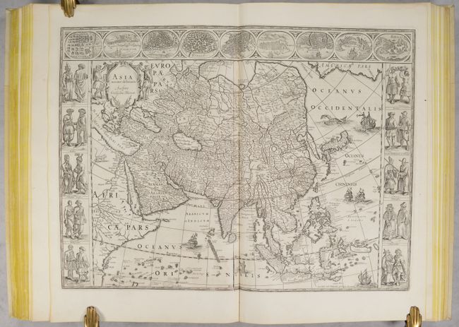
Asia Noviter Delineata. This is one of the most famous 17th century maps of the continent of Asia. It is surrounded by a beautiful carte-a-figures border and is richly ornamented with animals, sea monsters, and sailing ships. The eastern coastline of Asia is severely truncated, Korea is shown as an island, and Japan is depicted on the Ortelius-Teixeira model. The Indian subcontinent is too narrow and the islands of Indonesia are very sketchy. A large island labeled Ceiram probably represents the western part of New Guinea. In the interior, the Caspian Sea is oriented on an east-west axis and there are several large erroneous lakes in China including the mythical Chiamay Lacus. The frieze across the top features vignettes of the cities of Candy, Calecut, Goa, Damascus, Jerusalem, Hormuz, Banten, Aden, and Macao. The inclusion of Banten reflects the emergence of the Dutch as a major commercial power in the East Indies. The side panels flanking the map depict costumed figures of the various Asian peoples.
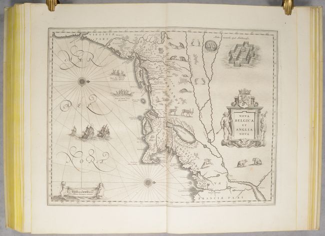
Nova Belgica et Anglia Nova. This important map, first issued in 1635, is one of the first to focus on the Dutch colony in North America and to name Nieu Amsterdam (New York). It is based on the manuscript of Andriaen Block (1614), a Dutch fur trader, who explored the area between Cape Cod and Manhattan and was the first to correctly delineate the longitudinal scale of the coastline and establish Manhattan as an island. The colony of Nieu Pleimonth is identified, as well as other English names along the coast, which were derived from Smith's map of New England in 1616. The map is oriented with north to the right and is richly adorned with a variety of wildlife, including the first appearance of beavers, polecats and otters on a printed map. Quebec is noted with a minute depiction of the fort and buildings, and the mythical kingdom of Norumbega is noted near the R. Pentagouet (Penobscot River) in present-day Maine. A large Mohawk village is shown derived from the White-de Bry engravings. It is further embellished with a large title cartouche flanked by two natives, sailing ships, canoes, and compass roses.
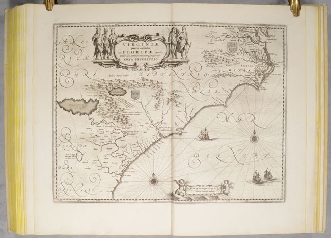
Virginiae Partis Australis, et Floridae Partis Orientalis… This lovely map of the Southeast extends from the southern part of Chesapeake Bay to northern Florida. Cartographically it improves on the Hondius map of 1606, on which it was derived, with the Chesapeake Bay correctly indicated as a large bay and the Carolinas and Georgian coasts depicted more accurately. The map presents the English and French colonial interests in the region as depicted by their respective royal arms. At the southern end of the Appalachians is a note concerning gold and silver mines. Richly decorated with a large cartouche flanked by Native Americans. The Atlantic Ocean contains two compass roses, three sailing ships and two aquatic putti holding the German scale of miles.
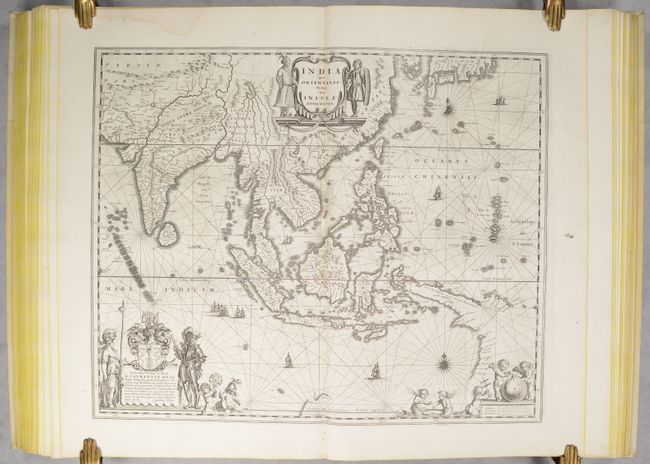
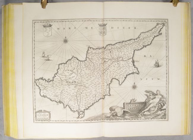
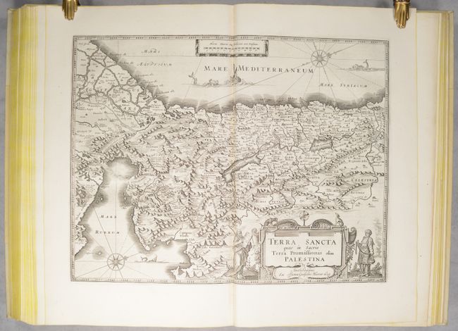
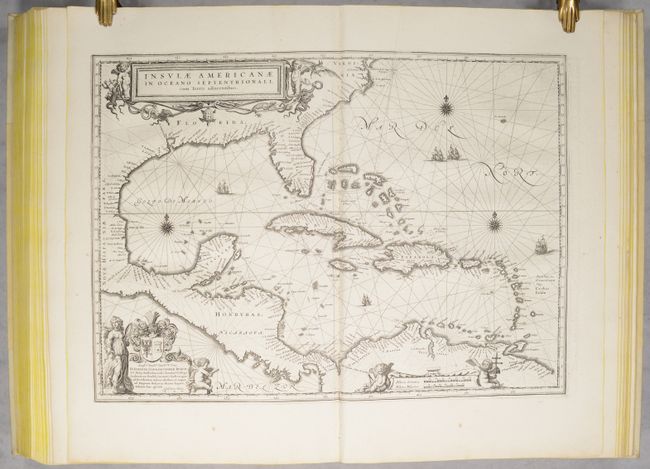
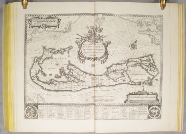
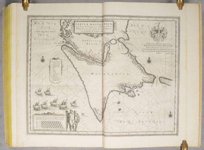
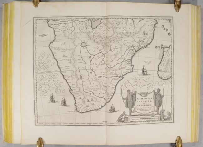
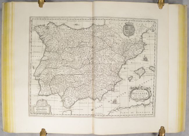
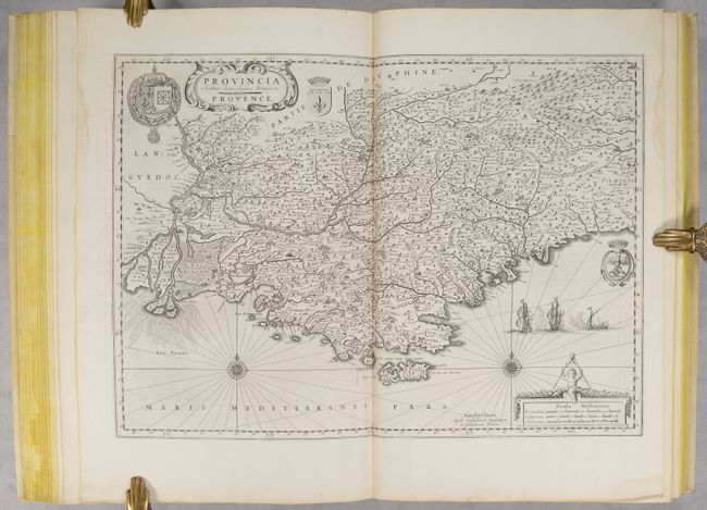
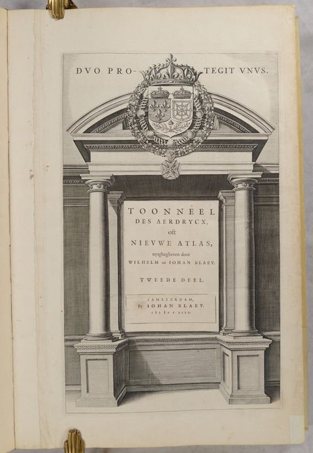
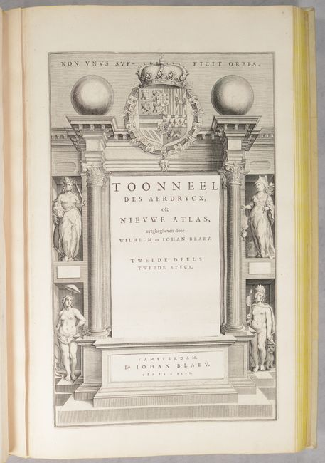
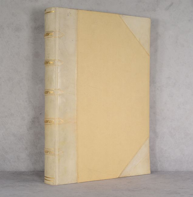
Other maps of interest include Bermuda, Gulf of Mexico, Tierra del Fuego, Cyprus, Holy Land, East Indies, Southern Africa, Spain, Switzerland, France, Provence, and many more. The missing maps are Africa, Western Hemisphere and Virginia. Each part includes an architectural title page flanked by columns, with the second title page including female personifications of the continents. Elephant folio with 89 maps, text, and two title pages. Hardbound in modern vellum with raised bands and gilt decorations on spine.
References: Van der Krogt (Vol. II) #2:221.
Condition: A
The maps are remarkably clean and bright with excellent impressions throughout. 84 of the maps are in A condition with occasional light printer's ink residue and sporadic narrow dampstains along the sheet edges, far from the images. The remaining 5 maps are in B+ condition with a few small stains and some printer's ink residue. The title page and a few other sheets have archival reinforcement along the right edge. Attractively rebound in modern vellum with some minor soiling on the covers.
Estimate: $12,000 - $15,000
Current High Bid:
$6,000
Reserve: Reserve Not Met
Next Bid: $6,500
Bid Increments
$5,000 - $9,999$500
$10,000 - $24,999$1,000
$25,000 - $49,999$2,500
$50,000 - $99,999$5,000
Terms & Conditions