Current Auction
Complete Atlas with 35 Maps in Contemporary Color
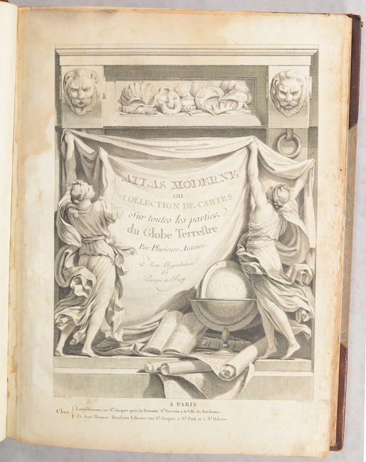
"Atlas Moderne ou Collection de Cartes sur Toutes les Parties du Globe Terrestre par Plusieurs Auteurs", Lattre, Jean
Subject: Atlases
Period: 1762 (published)
Publication:
Color: Hand Color
Size:
12 x 15.3 inches
30.5 x 38.9 cm
Download High Resolution Image
(or just click on image to launch the Zoom viewer)
(or just click on image to launch the Zoom viewer)
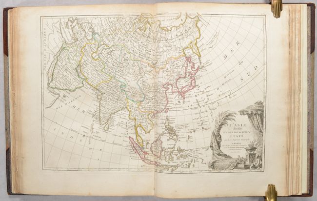
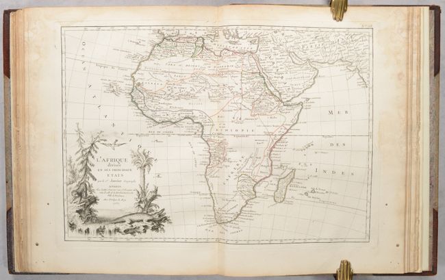
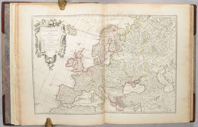
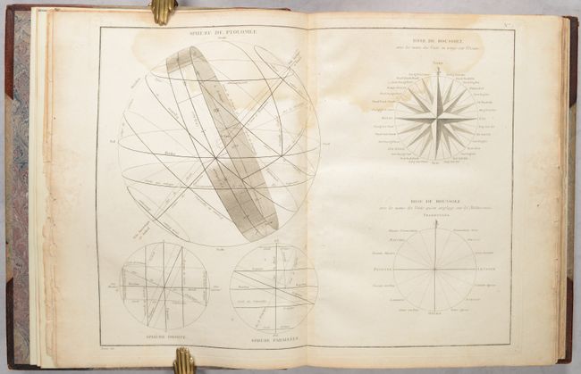
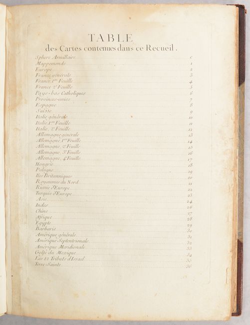
This complete atlas contains 35 double-page maps as stated on the list of maps representing all regions around the world, an engraving of an armillary sphere, and a lovely title page featuring a globe, atlases, maps, and symbols of the four continents. The maps include a world map, 22 maps related to Europe (with a four-sheet map of Germany and two-sheet maps of France and Italy), 4 maps related to Asia, 3 maps related to Africa, 4 maps related to the Americas, and a map of the regions of the New Testament. Most of the maps include an elaborate and superbly engraved title cartouche featuring emblems of the region. This atlas includes two extra maps - both a large and small folding map of France, for a total of 37 maps. Some of the noteworthy maps in this atlas include:
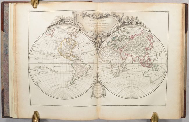
Mappe-Monde ou Description du Globe Terrestre, Assujettie aux Observations Astronomiques. In North America there is a distinct Northwest Passage connecting Hudson Bay with the large Sea of the West and the Pacific. Alaska is shown in dotted outline as an extremely lengthy peninsula based on the Russian discoveries of Bering and Tschirikow. Australia is shown attached to both Tasmania and New Guinea with a conjectural eastern coastline incorporating Terre du S. Espirit (New Hebrides), as is commonly found on French maps at the time. The place name Terre de Diemen is shown twice, in Tasmania and in Arnhem Land in the region of today's Darwin. New Zealand is shown as just a little scribble of coastline in the South Pacific.
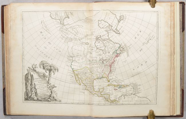
L'Amerique Septentrionale Divisee en ses Principaux Etats. This fascinating map shows the imaginary Sea of the West and a Northwest Passage stretching from Baffin Bay to the Archipel St. Lazare on the Pacific coast. The gigantic Sea the West, near modern-day Seattle, is connected to the Pacific by the straits of Juan de Fuca and Martin d' Aguilar. New Albion is on the southwest shore of this great inland sea, which inundates virtually all of present-day British Columbia and Alberta. There is not any sign of a recognizable Alaska. The British colonies are confined east of the Appalachian Mountains with French Louisiana stretching to the Pacific Northwest. Florida is controlled by Spain. Ft. Cenis and Santa Fe are visible within the Spanish territories in the southwest, labeled Nouveau Mexique here. The large, decorative title cartouche, incorporating a palm tree and grape vines, was engraved by Berthault.
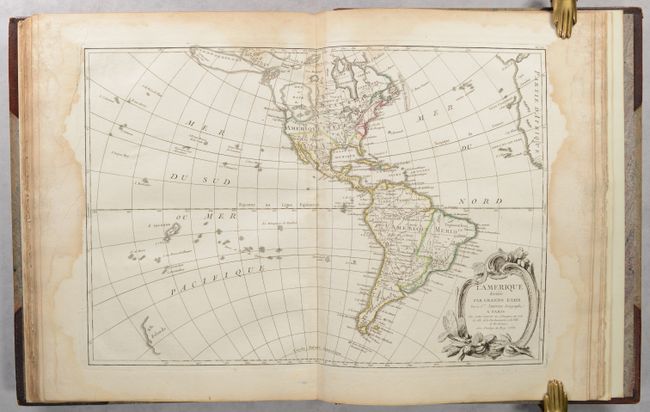
L'Amerique Divisee par Grands Etats. This fine map of the Americas again shows a huge, imaginary Sea of the West and hints of a possible Northwest Passage, and a rudimentary Alaska. In North America, the British colonies are shown east of the Allegheny mountains, French Louisiana takes in most of the interior and Spain controls Florida, New Mexico and Mexico. There are several islands shown in the Pacific and just the western coastline of New Zealand.
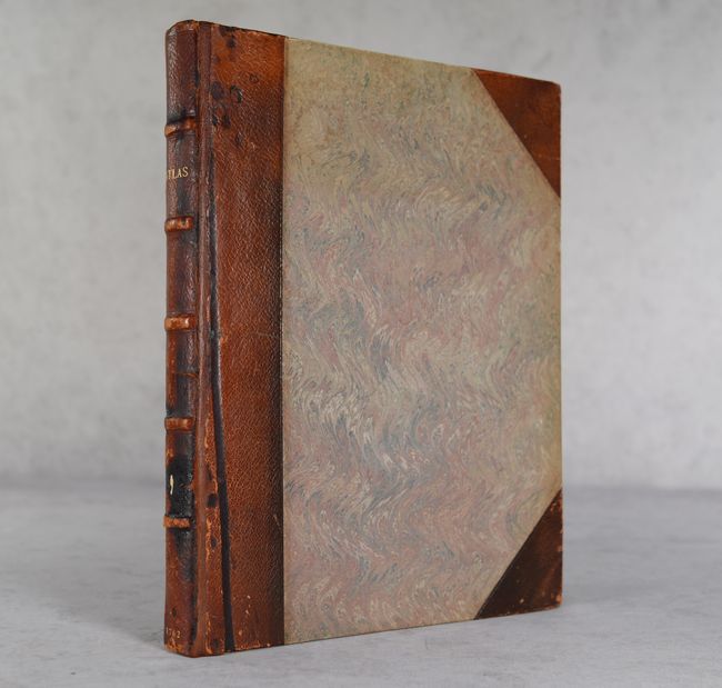
Rebound in quarter leather with tips over marled boards.
References: McGuirk #107-109; Perry & Prescott #1762.01.
Condition: B+
All maps are in contemporary outline color and range from good to mostly very good. There is a dampstain along the upper centerfold that is more prominent through the first 6 maps and fades in the back half of the atlas. There is additional dampstaining in the blank margins of the last 7 maps, only 2 of which just touch the borders. The large (extra) folding map of France has a few fold separations including a 5" separation at top right, and the map of northern Africa is lightly toned. There is some roughness along the right edge with chipping to the title page, advertisement, and list of maps. Rebound with new backstraps and endpapers. Covers have some wear and spine is stained with a small chip.
Estimate: $2,000 - $2,300
Current High Bid:
$1,500
Reserve: Reserve Met
Next Bid: $1,600
Bid Increments
$1,000 - $2,499$100
$2,500 - $4,999$250
$5,000 - $9,999$500
$10,000 - $24,999$1,000
Terms & Conditions