Current Auction
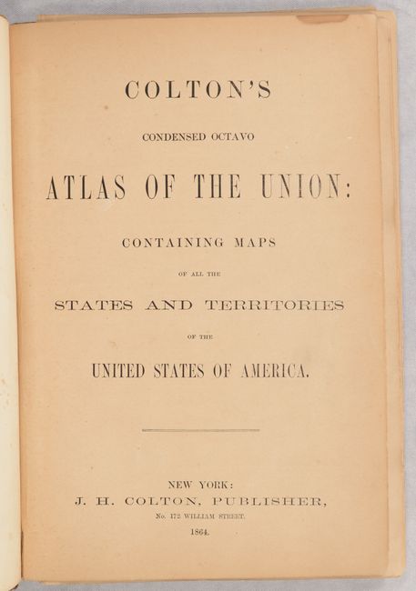
"Colton's Condensed Octavo Atlas of the Union: Containing Maps of All the States and Territories of the United States of America", Colton, Joseph Hutchins
Subject: Atlases
Period: 1864 (published)
Publication:
Color: Hand Color
Size:
6.5 x 9.6 inches
16.5 x 24.4 cm
Download High Resolution Image
(or just click on image to launch the Zoom viewer)
(or just click on image to launch the Zoom viewer)
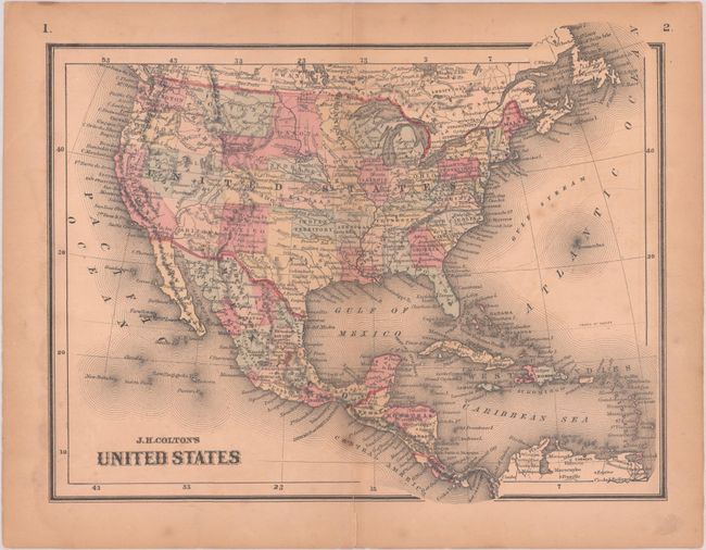
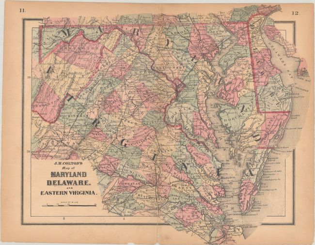
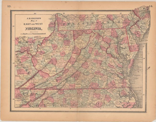
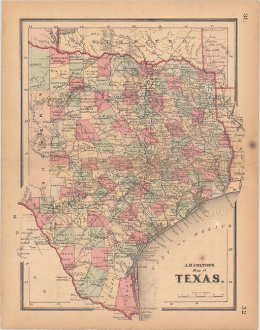
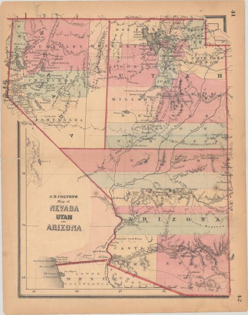
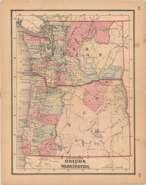
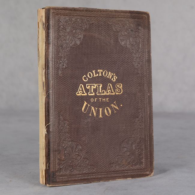
This atlas contains a total of 25 maps covering the states and territories of the United States, including 24 double-page maps and 1 folding map of California. Issued during the Civil War, it contains several maps not seen in other Colton atlases including Maryland Delaware, and Eastern Virginia and East and West Virginia. This latter map shows the borders for the new state of West Virginia but is called Western Virginia. The atlas also includes a nice map of the entire United States, state maps of Texas and Florida, and several maps showing the evolving western territories. Octavo, hardbound in brown cloth with embossing and gilt title on the front cover. The atlas appears complete, however the maps are all loose.
References:
Condition: B
The maps are all loose from the binding, with light toning and an occasional spot of foxing. Most of the maps have short centerfold separations or edge tears, some of which have been closed on verso. The maps of Missouri/Kansas and California/Idaho have a small chip within the image. The folding map of California has archival tissue repairs along the bottom 1" of the map on both recto and verso. The title page and text are also lightly toned, and there is a previous owner's printed bookplate (Wm. Alex'r Steel) on inside front cover. The spine is perished. The covers are worn and the front cover is nearly detached.
Estimate: $550 - $700
Current High Bid:
$0
Reserve: Reserve Not Met
Next Bid: $275
Bid Increments
$250 - $499$25
$500 - $999$50
$1,000 - $2,499$100
$2,500 - $4,999$250
Terms & Conditions