Current Auction
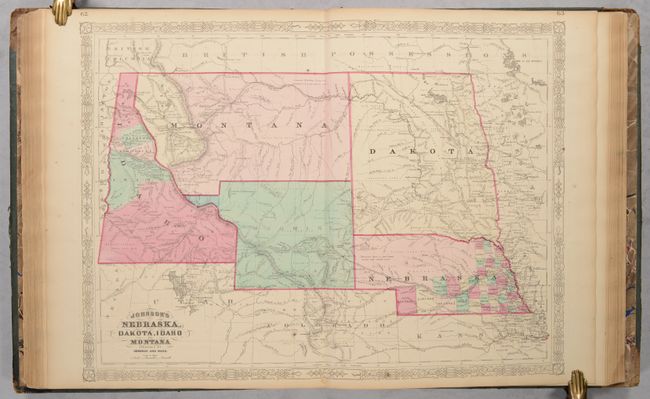
Features an Early Rendering of Wyoming Territory
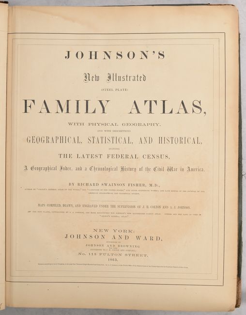
"Johnson's New Illustrated (Steel Plate) Family Atlas, with Physical Geogeaphy, and with Descriptions Geographical, Statistical, and Historical...", Johnson and Ward

Subject: Atlases
Period: 1865 (published)
Publication:
Color: Hand Color
Size:
14.8 x 18.5 inches
37.6 x 47 cm
Download High Resolution Image
(or just click on image to launch the Zoom viewer)
(or just click on image to launch the Zoom viewer)
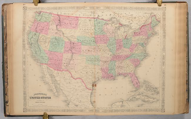
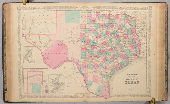
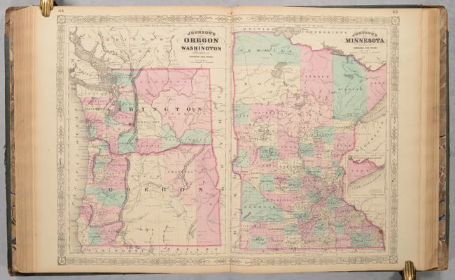
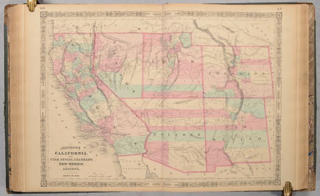
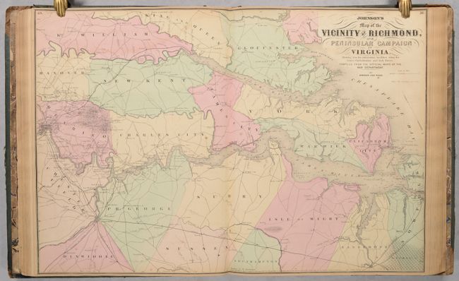
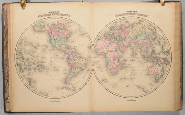
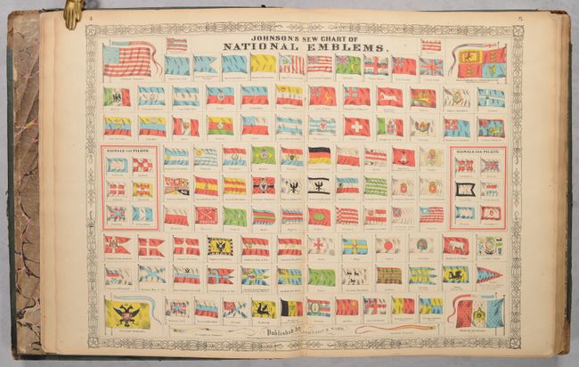
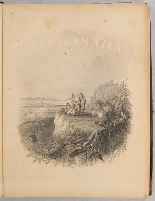
This attractive and complete folio atlas includes the beautiful American Atlas frontispiece showing Native Americans overlooking a rapidly developing river valley, several interesting thematic maps, and a plate showing the flags of all nations. Also included is the uncommon Johnson's Nebraska, Dakota, Idaho and Montana, a colorful double-page map that shows a very early rendering of Wyoming Territory with its western boundary incorrectly formed. This same map shows Montana with a separate western region called Missoula, which is situated between the Rocky Mountains and the eastern Idaho boundary. Also of interest is Johnson's New Map of the State of Texas depicts county development mostly in eastern Texas and only the three large counties of El Paso, Presidio, and Bexar organized in the west. The panhandle, noted as the Staked Plains (Elevated Table Land, without Wood or Water), includes a large section that is unorganized. Also contains the Civil War Map of the Vicinity of Richmond and Peninsular Campaign in Virginia. Complete with 105 maps on 63 sheets as called for on the List of Maps. Hardbound in contemporary green cloth with quarter calf spine and tips with titling in gilt on front cover and spine.
References:
Condition: B+
The maps are good to very good with light toning, scattered foxing, and some dampstaining along the upper corners of the pages. The map of Wisconsin and Michigan has a centerfold tear with significant loss (0.75" x 3.5"). Binding is tight with stained and scuffed covers and some loss of leather on tips and spine.
Estimate: $1,000 - $1,300
Current High Bid:
$0
Reserve: Reserve Not Met
Next Bid: $500
Bid Increments
$500 - $999$50
$1,000 - $2,499$100
$2,500 - $4,999$250
$5,000 - $9,999$500
Terms & Conditions