Current Auction
Third Volume of the Great Civil War Atlas, with Desirable Uniform and Flag Plates & Political Maps
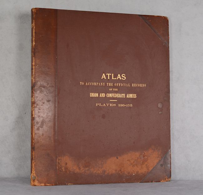
"Atlas to Accompany the Official Records of the Union and Confederate Armies - Plates 136-175", U.S. War Department
Subject: Atlases, United States, Civil War
Period: 1891-95 (published)
Publication:
Color: Printed Color
Size:
15.6 x 18.6 inches
39.6 x 47.2 cm
Download High Resolution Image
(or just click on image to launch the Zoom viewer)
(or just click on image to launch the Zoom viewer)
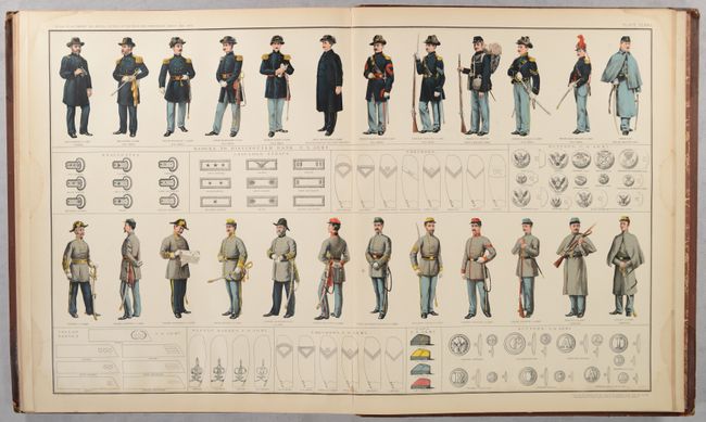
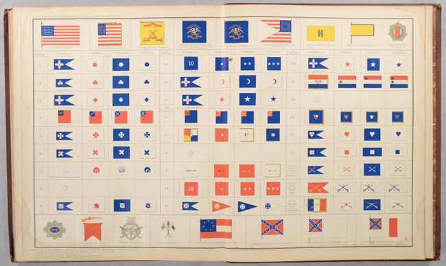
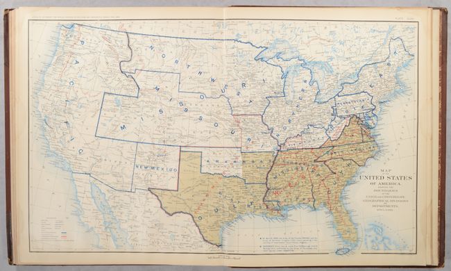
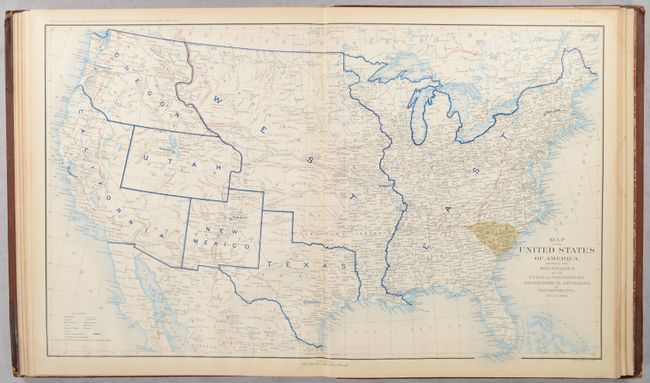
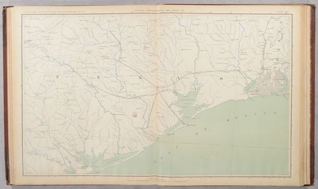
This is the third volume of the government's publication covering the Civil War. The third volume includes plates #136-175 of the 178-plate set (plates #176-178 were issued separately as supplements). The first 26 plates of this volume are topographical section maps covering the theater of war in intricate detail. Perhaps most interesting are Plates #162-171, the sought-after set of political maps of the United States tracking the changing positions of the Union and Confederate armies every six months from the end of 1860 to the Confederate surrender in April 1865. The remaining plates cover uniforms, artillery, transportation, and flags. These plates were issued between 1891 and 1895 to accompany the Official Army Records and were published under the Secretaries of War Redfield Proctor, Stephen B. Elkins, and Daniel S. Lamont by Maj. Gen. George B. Davis, assisted by civilian experts Leslie Perry and Joseph Kirkley. The plates were compiled by Capt. Calvin D. Cowles, 23rd U.S. Infantry. Very finely engraved and detailed. Hardbound in the quarter leather and tips over red cloth boards with gilt titles on front cover and spine.
References:
Condition:
Approximately 25% of the maps/plates are good (B) and 75% are very good (B+) with light to moderate dampstaining that is visible at the bottom of some plates. Covers are stained and soiled with bumped and chipped corners and shelf wear along the edges and spine.
Estimate: $600 - $750
Current High Bid:
$0
Reserve: Reserve Not Met
Next Bid: $300
Bid Increments
$250 - $499$25
$500 - $999$50
$1,000 - $2,499$100
$2,500 - $4,999$250
Terms & Conditions