Auction closes in 16h 41m
Current Auction
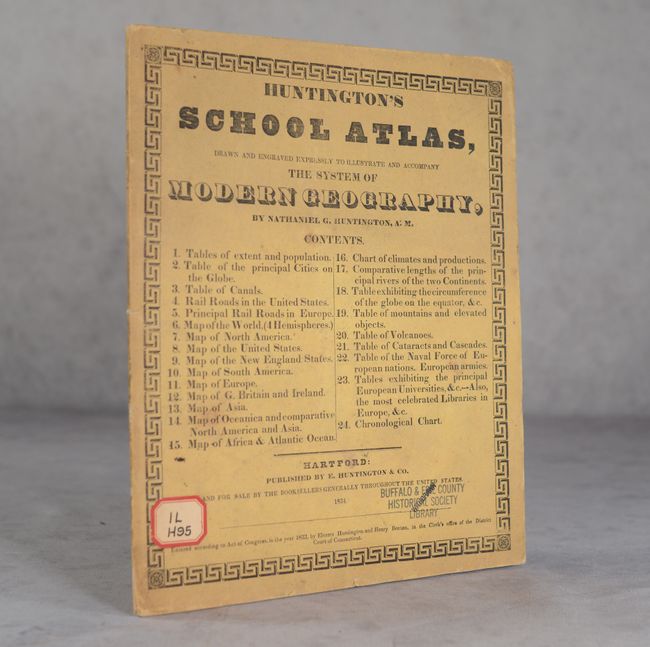
"Huntington's School Atlas, Drawn and Engraved Expressly to Illustrate and Accompany the System of Modern Geography", Huntington, Eleazor

Subject: School Atlases
Period: 1834 (published)
Publication:
Color: Hand Color
Size:
9.6 x 11.6 inches
24.4 x 29.5 cm
Download High Resolution Image
(or just click on image to launch the Zoom viewer)
(or just click on image to launch the Zoom viewer)
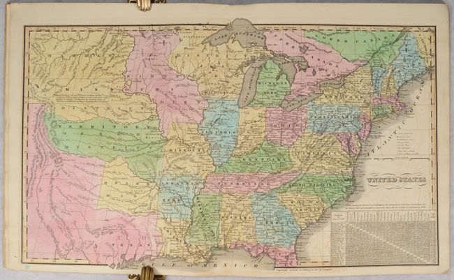
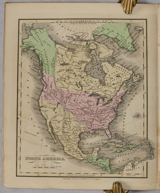
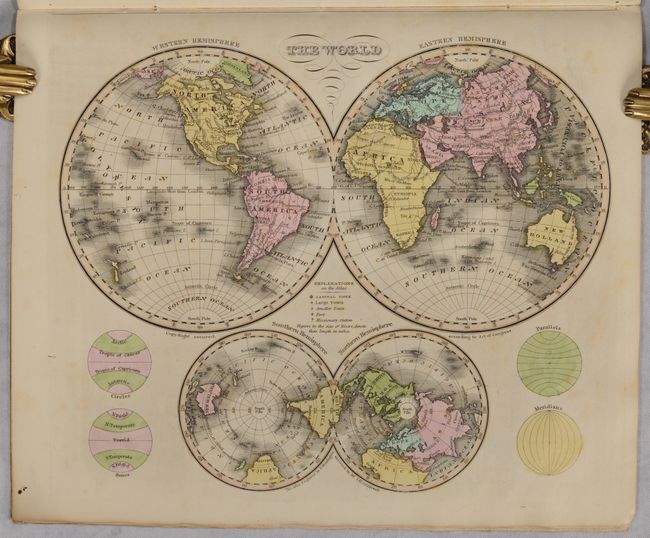
This quality school atlas contains 1 double-page map of the United States and 10 single-page maps. The map of the United States stretches to the Rocky Mountains and shows Texas as a part of Mexico. A large Missouri Territory covers the middle of the country and is filled with Indian districts including the Sioux, Mandan, Osage and Ozark tribes. Wisconsin is shown as "attached to Michigan." The map of North America also shows Mexico in control of the Southwest and the U.S. border with Canada extends well into British Columbia, reflecting U.S. interests in the region. The atlas also includes two world maps, South America, Europe, Asia, Africa and Oceania. Printed paper covers.
References: Phillips (Atlases) #295.
Condition: A
Condition code is for the maps, which are remarkable clean and bright for an early school atlas with light offsetting primarily on the maps of Europe and Great Britain (which are B+ condition). Text has scattered foxing and the covers are lightly soiled. Ex-library with a withdrawn stamp on the front cover.
Estimate: $350 - $425
Current High Bid:
$0
Reserve: Reserve Not Met
Next Bid: $180
Bid Increments
$100 - $249$10
$250 - $499$25
$500 - $999$50
$1,000 - $2,499$100
Terms & Conditions