Current Auction
"A New Map of Nova Scotia, Newfoundland &c. from the Latest Authorities", Cary, John
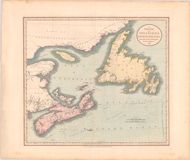
Subject: Eastern Canada
Period: 1828 (dated)
Publication: New Universal Atlas
Color: Hand Color
Size:
20.3 x 18 inches
51.6 x 45.7 cm
Download High Resolution Image
(or just click on image to launch the Zoom viewer)
(or just click on image to launch the Zoom viewer)
This early 19th-century map focuses on the area around the Gulf of St. Laurence, with excellent detail of the coasts of Nova Scotia and Newfoundland. The fishing banks in the Atlantic Ocean are prominently depicted.
References: cf. Phillips (Atlases) #745-53.
Condition: A
A crisp impression with full contemporary color on a sturdy sheet with the watermarks of "T. Edmonds 1830" and "Not Bleached." There is minor toning along the centerfold and sheet's edges and a centerfold separation confined to the bottom blank margin.
Estimate: $140 - $170
Current High Bid:
$80
Reserve: Reserve Not Met
Next Bid: $85
Bid Increments
$50 - $99$5
$100 - $249$10
$250 - $499$25
$500 - $999$50
Terms & Conditions